Kopjes Kraal
123 on the cadastre · on record 1859–1941 · show on the map
- Farm number
- No. 123
- On the cadastre
- 123, whole farm
- District
- Prince Albert
- Extent, as the diagram states it
- 4982 morgen 370 sq roods (1863 survey)
- Modern surveyed area
- 4272.2 ha
The historic extent and the modern surveyed area are two separate measurements and are not presented here as confirming each other. The first is what a surveyor wrote on a diagram, usually in morgen. The second is what the modern cadastre draws.
Why this farm is here
Ger(H)olm Marincowitz held it. 23 km from Klaarstroom.
Ger(H)olm Marincowitz is on record on this ground directly. No trace needed.
- story A written history names this ground Rondabel No. 124: a farm history
- story A written history names this ground The war reaches the Koup
- story A written history is set on this ground Kopjes Kraal: a farm that lost a quarter of itself, and a road nobody uses
- story A written history names this ground Twenty-four months
- …and 2 more, listed in full further down this page.
Stories
- mentions this farm
Rondabel No. 124: a farm history
From a loan-farm widow who signed with a mark to the Marincowitz farm of today: the full documented history of Rondabel No. 124 - the Venter household of 1829, the twelve-farm grant day of 1841, the Oosthuizen-Theron partnership of 1868, the 1910-34 subdivisions, and the two graves by the huis nobody has read.
- mentions this farm
The war reaches the Koup
The Anglo-Boer War came to these farms twice: up the road from Klaarstroom on 2 February 1901, when a running fight through Die Gang left a Boer of Scheepers's commando dead on Remhoogte; and quietly in 1903, when a woman from Tulbagh married into a Prince Albert family having buried two brothers in Natal thirty-four days apart - two brothers Deneys Reitz very probably names in Commando.
- about this farm
Kopjes Kraal: a farm that lost a quarter of itself, and a road nobody uses
Crown land surveyed in 1859 at 6,325 morgen and resurveyed four years later at 4,982 - about 1,343 morgen fewer, unexplained. Granted in 1871 to Gerolm Marincowitz of Trieste, whose surname reaches the Karoo from the Adriatic and not from the Netherlands. A stock route across it was ended by a line in a provincial gazette in 1926, and half of what was left became Kromrivier in 1934.
- mentions this farm
Twenty-four months
Between February 1858 and February 1860 the Koup acquired a road to the sea, buried the couple the whole district descends from, laid out a village, had Crown land surveyed on its eastern edge, and met the industry that paid for the next forty years.
- mentions this farm
The words on the papers
A glossary of the words these documents actually use — leeningsplaats, opstal, erfpacht, kwitrent, morgen and square roods, veldkornetskap, Weeskamer, vendue, d'oude — each illustrated by a verbatim line from the family's own papers.
What the record holds, in order
-
November 1859
document
SG diagram 1927/1860
P.A.Q.1-17
-
November 1863
document
SG diagram 1035/1871 (pt 1)
P.A.Q.1-28
-
November 1863
document
SG diagram 1035/1871 (pt 2)
P.A.Q.1-28
-
17 May 1871
ownership
Ger(H)olm Marincowitz (11 February 1805–13 May 1890)
quitrent · grant · confidence high
- 1934 boundary change subdivision: becomes Kromrivier (Kopjes Kraal No. 123 Ptn 1)
- 1934 boundary change remainder: becomes Kopjes Kraal No. 123 Remainder
-
30 October 1941
burial
Gerolm Samuel Marincowitz (22 June 1870–30 October 1941)
Kopjes Kraal 123 farm cemetery, Not read by this project; recorded from the eGGSA caption, which is a transcription made by somebody else.
- undated document SG diagram verso 1035/1871 (verso)
Ground cut out of this farm
- Kromrivier (Kopjes Kraal No. 123 Ptn 1) 1/123 · 1992.3 ha
- Kopjes Kraal No. 123 Remainder RE/123 · 2279.9 ha
Bordered by, as the diagram names them
- N Perseken Hoogte
- E Minies Kraal
- E Oude Muure
- S Klip Fontein
- W Rondabel
Buried on this ground
- Kopjes Kraal 123 farm cemetery 1 graves recorded, 1 identified in this project
The burials also appear on this farm's timeline above, each at its own date.
Also bordered by, as the modern cadastre draws it
Ground that touches this farm on the Surveyor-General's current polygons and that none of the diagrams held here names. Derived from the geometry, not read off a document.
- N Klipgat No. 114
- NE Aschkop (Klipgat No. 114 Ptn 10)
- E Minnies Kraal No. 112
- E Nuwejaarsfontein (Minnies Kraal No. 112 Ptn 7)
- SE Klipfontein A No. 174
- SE Klipfontein Oost (Klipfontein A No. 174 Ptn 1)
- SE Minnies Kraal No. 112 Ptn 5
- S Kopjes Kraal No. 123 Remainder
- S Klipfontein A No. 174 Remainder
- S Driehoek (Rondabel No. 124 Ptn 4)
- W Rondawel (Rondabel No. 124 Ptn 1)
- NW Kromrivier (Kopjes Kraal No. 123 Ptn 1)
Documents
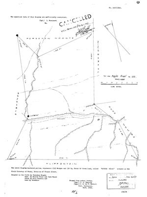 Surveyor-General diagram, 1927/1860, November 1859
SCAN325.TIF
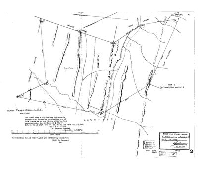 Surveyor-General diagram, 1035/1871 (pt 1), November 1863
10513279.TIF
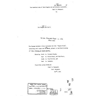 Surveyor-General diagram, 1035/1871 (pt 2), November 1863
10513540.TIF
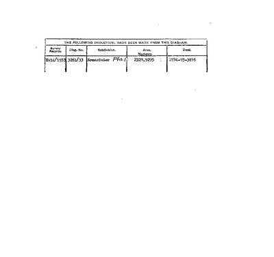 Diagram verso, 1035/1871 (verso)
10513280.TIF
Cadastre
Surveyor-General diagram index for this parcel
Research notes
Marincowitz farm. Originally Crown Land: 6325 mg 330 sr on the 1859 survey (title 1862), resurveyed 1863 at 4982 mg 370 sr (title 1871) - about 1,343 morgen smaller [TO VERIFY why]. Field Cornetcy of Traka. Lies between Rondabel (W) and Oude Muure (E), both also Marincowitz.
[SRC-318, 7 Aug 2026] A FARM CEMETERY IS RECORDED ON THIS GROUND BY eGGSA: 'Kopjes Kraal 123, Koppieskraal', Cemetery ID 6501, at -33.214633, 22.711100. Photographs and captions at https://graveswcape.eggsa.org/PRINCE-ALBERT-Rural/0119038%20WC%20Koppieskraal/ - linked, not copied.
The research behind this page, kept separate from it: dated working notes, open questions, and what is not yet settled.
Open questions
-
Morgen or hectares? extent_text may be inconsistent
priority 1 · LEAD-0007
Are the figures in parcels.extent_text really morgen, or are some of them hectares mislabelled as morgen?
What would settle it Reading the figure and its unit directly off the diagrams for the nine flagged parcels.
What the record is missing
-
The record stops in 1871 and never resumes
second order · B2 trail-ends
Kopjes Kraal was worked as far as 1871-05-17, with Ger(H)olm Marincowitz the last owner on record. 155 years follow with nothing. Who held it after that, and is it still one farm?
What would settle it The current title deed traced backwards, each transfer names the one before it, or the Surveyor-General's subdivision diagrams, which are what usually explain a farm going quiet.
-
“Minies Kraal” is named as a neighbour 2 times and we hold no parcel for it
third order · B3 unheld-farm
2 separate surveys in this model put Minies Kraal on the boundary of ground we do hold (PAR-000026, PAR-000029). It has no parcel of its own here, so nothing is known about who held it or when, while it borders farms at the centre of the project.
What would settle it The Surveyor-General's farm index for the registration division will give it a farm number and a diagram; the cadastre pull in `data/fetch_cadastre.py` then places it on the map.
Found by breaks.py reading the model against itself, not written by hand,
each one is a shape of missing record, not a fault in the data.
The whole set is on the
questions page.