Surveyor-General diagram, 3273/1933, January 1919
Surveyor-General diagram, January 1919
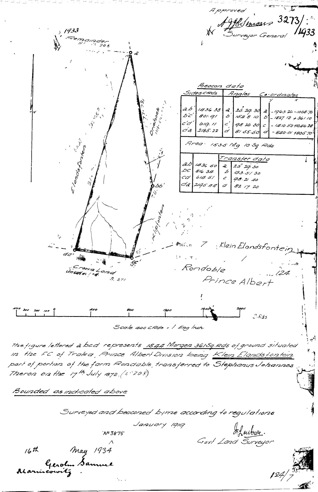
10TSVT01 (1).TIF.The record
- Type
- Surveyor-General diagram
- Diagram number
- 3273/1933
- Surveyed
- January 1919
- Titled
- 16 May 1934
- Deed
- 3875
- Surveyor
- J.A. Loubser
- Examiner
- A.J.J. Simons
- Archive filename
- 10TSVT01 (1).TIF
Citation
- Title
- Rondabel Portion 7 "Klein Elandsfontein" diagram
- Repository
- Surveyor-General
- Reference
- SG Dgm 3273/1933
- Type
- SG diagram
The ground it is about
Klein Elandsfontein (Rondabel No. 124 Ptn 7) 7/124
Research notes
Portion 7 "KLEIN ELANDSFONTEIN", 1544 morgen 361 sq roods. Transfer 16 May 1934 in favour of GEROLM SAMUEL MARINCOWITZ.
[5 Aug 2026] MERGED DOC-0192 INTO THIS ROW - one sheet, two rows. Same sheet: same diagram 3273/1933, same survey and title dates, same archive token 10TSVT01, same Portion 7 extent. Filed at the whole farm in July and at the portion on 3 Aug. DOC-0192 is retired and its id will never be reused. Moved across: examiner=A.J.J. Simons. DISAGREEMENTS between the two rows, recorded rather than resolved: par_id: kept 'PAR-000009', DOC-0192 said 'PAR-000045'; original_filename: kept '10TSVT01 (1).TIF', DOC-0192 said '10TSVT01 124 7.jpg'; source_file: kept 'sources/diagrams/DOC-0048-rondabel-ptn7-kleinelandsfontein-1933.tif', DOC-0192 said 'sources/diagrams/DOC-0192-rondabel-124-ptn7-kleinelandsfontein-1933.jpg'; deed_ref: kept '3875', DOC-0192 said '3875 of 16.5.1934'; surveyor: kept 'J.A. Loubser', DOC-0192 said 'J. Loubser'; source_id: kept 'SRC-061', DOC-0192 said 'SRC-226'; image_edtf: kept '1933', DOC-0192 said '1934'.
[5 Aug 2026] par_id moved from PAR-000009 (Rondabel, the whole farm) to PAR-000045 (Klein Elandsfontein, Rondabel Portion 7). The sheet describes Portion 7 by name and extent, 1544 morgen 361 square roods; the July filing put it on the parent farm because the archive filename carried no portion hint.
The research behind this page, kept separate from it: dated working notes, open questions, and what is not yet settled.