Deel van Vrolikheid
Faans Kraal (Vrolikheid Nr. 177 Gdlt 4)
4/177 op die kadaster · op rekord 1934–1936 · wys op die kaart
Die plaas se eie geskiedenis — die toekenning, die oorspronklike opmeting — sit op daardie bladsy.
- Plaasnommer
- Nr. 177
- Gedeelte
- 4
- Op die kadaster
- 4/177, gedeeltegeregistreer as VROLYKHEID
- Distrik
- Prince Albert
- Grootte, soos die kaart dit stel
- 2113.5677 morgen
- Moderne opgemete oppervlakte
- 1775.5 ha
Die historiese grootte en die moderne opgemete oppervlakte is twee aparte metings en word hier nie aangebied asof hulle mekaar bevestig nie. Die eerste is wat 'n landmeter op 'n kaart geskryf het, gewoonlik in morg. Die tweede is wat die moderne kadaster teken.
Waarom hierdie plaas hier is
Vincent Charles Marincowitz het dit gehou. 7 km van Klaarstroom.
Vincent Charles Marincowitz is regstreeks op hierdie grond aangeteken. Geen spoor nodig nie.
- storie 'n Geskrewe geskiedenis speel op hierdie grond af Vrolykheid No. 177: a farm history
- perseel Uitgesny uit Vrolikheid
- grens Deel 'n grens met Wit Plaats (Vrolikheid Nr. 177 Gdlt 1) Wit Plaats (Vrolikheid Nr. 177 Gdlt 1)
- grens Deel 'n grens met Uitkyk Nek (Vrolikheid Nr. 177 Gdlt 2) Uitkyk Nek (Vrolikheid Nr. 177 Gdlt 2)
- …en nog 2, volledig gelys verder af op hierdie bladsy.
Stories
- about this farm
Vrolykheid Nr. 177: 'n plaasgeskiedenis
Die plaas waar die papier en die mense verskil. Stretch se opmeting van 1833 dra al klaar die name van gedeeltes wat eers 'n eeu later gesny word; twee titels gaan op een dag in 1841 uit, een aan 'n Oosthuisen en een aan 'n 'N. Hitge' wie se akte deur vier latere gedeeltes aangehaal word; 'n Triëstenaar trou in 1844 met 'n Hitge en hou die plaas toe hy in 1890 sterf; en 'n sterfkennis sit die Hitges uiteindelik self op die grond.
Wat die rekord hou, in volgorde
- 1934 boundary change subdivision: from Vrolikheid
-
Julie 1934
document
SG diagram 4933/1934
8110
-
24 Augustus 1936
ownership
Vincent Charles Marincowitz (23 April 1877–6 Februarie 1950)
transfer · confidence high
Begrens deur, soos die kaart hulle noem
- N Uitkyk Nek
- NE Wit Plaats
- E Marinco
- N Klaarstroom (Remainder of Lot C)
- W Wilgemond (Remainder)
- S Witberg
Ook begrens deur, soos die moderne kadaster dit teken
Grond wat aan hierdie plaas raak op die Landmeter-generaal se huidige poligone en wat geen kaart wat hier gehou word, noem nie. Afgelei uit die meetkunde, nie van 'n dokument afgelees nie.
Dokumente
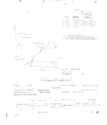 Landmeter-generaal-kaart, 4933/1934, Julie 1934
10X2V901.TIF
Kadaster
Die Landmeter-generaal se kaartindeks vir hierdie perseel
Die Landmeter-generaal se kaartindeks vir die hele plaas — waar die oorspronklike opmeting van hierdie grond lê.
Navorsingsnotas
SG Dgm 4933/1934; deed 24.8.1936-8110. Vischat (PAR-000008) lies in Faans Kraal. [Confirmed 29 Jul 2026 via DOC-0072, the portion's own diagram] Deed number and date match exactly. [CORRECTED 29 Jul 2026, verification pass] Extent is 213.5677 morgen: DOC-0072's face and DOC-0028's verso (re-read) agree exactly; the row's earlier 213.9677 was a misread of the verso. Also cites the 1841 N. HitgeM antecedent title (B.W.Q.5.18), the same as Wit Plaats/Uitkyk Nek/Marinco - see PAR-000014/PAR-000035 notes and LEAD-0009. NOTE the modern cadastre's Ptn 4 (1,776.0 ha) cannot be this 213.5677mg (= 182.9 ha) parcel - left unmatched, LEAD-0008. The diagrams spell it "Faans Kraal" (DOC-0072 face, DOC-0028 verso, DOC-0068 map); probably "FRANS KRAAL" - current_name keeps Faans Kraal, the document spelling is recorded here, neither normalised away.
[1 Aug 2026, re-read of DOC-0068 and DOC-0072] TWO CORRECTIONS OFF THE DIAGRAM ITSELF. (1) NAME: it is FAANS KRAAL, not Faans Kraal. The diagram sets it in capitals twice - 'Portion 4 (Faans Kraal)' and 'called FAANS KRAAL' - and the 1936 transfer event already read it that way. Previous value: Frans Kraal (Vrolykheid Ptn 4). (2) EXTENT: the diagram reads 'represents 2113.5677 Morgen'. This row carried 213.5677 morgen - SHORT BY 1,900 MORGEN, a dropped leading digit. That is about 1,630 hectares missing from a farm of 1,810, so it was not a rounding slip; it made the portion look one-tenth of its real size. Corrected to 2113.5677 morgen. (3) FIELD CORNETCY: KREDOUW, not Traka - see below.
[1 Aug 2026, re-read of DOC-0068 and DOC-0072] FIELD CORNETCY = KREDOUW. On BOTH 1934 Melville diagrams the printed line reads 'situate in the Field Cornetcy of' with TRAKA STRUCK OUT AND KREDOUW WRITTEN IN, in the surveyor's hand. Two independent sheets, the same deliberate correction. So this ground sat in the KREDOUW ward of the Prince Albert division, not the Traka ward - and that is the answer to where 'aan Kriedouw' in the 1821 Beaufort West baptisms points. See LEAD-0052.
[13 Aug 2026] Renamed to the one form this model uses for every portion - the portion's own name, then the parent farm, its number and the portion in brackets - so that a name is legible in a list, a search result and a map popup without the reader having to know which farm number is which. It read "Faans Kraal (Vrolykheid Ptn 4)" before. Nothing about the ground changed.
Werknotas, hier gewys omdat dit 'n private navorsingsbou is.
Die werksnotas op hierdie werf word in Engels gehou en word nie vertaal nie. Hulle verander met elke navorsingsessie, en 'n vertaling sou uit pas raak met die oorspronklike. Alles anders — die stories, die getranskribeerde dokumente en die koppelvlak — is in Afrikaans.
Oop vrae
-
match_cadastre.py no longer reproduces the geometry on disk
prioriteit 1 · LEAD-0017
Re-running match_cadastre.py against the current CSVs changes 11 parcels and does not reproduce what is in parcels.csv. Which is right?
Wat dit sou uitmaak Deciding per parcel whether the script's match or the hand entry is correct, then either fixing the script's name-matching or recording the hand values as deliberate.
-
Our portion numbers do not match the SG on Vrolykheid and Spreeufontein
prioriteit 2 · LEAD-0008
Do our portion numbers for Vrolykheid and Spreeufontein correspond to the Surveyor-General portion numbers, or are they our own sequence?
Wat dit sou uitmaak The portion number printed on each diagram, against the SG portion number in the cadastre.
-
N. Hitge's true footprint on Vrolykheid - and his relationship to Frans's own Hitge ancestors
prioriteit 2 · LEAD-0009
Did N. HitgeM's 1841 title (B.W.Q.5.18) actually cover more of Vrolykheid than the ~2,177-morgen Wit Plaats portion recorded for him - and how is N. HitgeM (PER-000044) related to Aletta Catharina Maria Helena HitgeM (PER-000139, Frans's own direct 2x-great-grandmother) and to Hester Carolina Adriana HitgeM (PER-000178, who married into the Marincowitz line)?
Wat dit sou uitmaak A record giving N. HitgeM's full given name and naming his children, matched against Aletta Catharina Maria Helena HitgeM (b.1846) and Hester Carolina Adriana HitgeM (b.1826) - if both are his daughters, or one his daughter and the other a niece or cousin, that settles the family relationship and gives a documented reason one 1841 title could legitimately be cited across multiple later Vrolykheid portions, subdivided within the Hitge family before ever reaching Marincowitz hands
-
Where exactly is Vischat / 'fisgat', and what is its real name?
prioriteit 2 · LEAD-0018
Vischat is where Frans's grandfather Hendrik Lodewyk Malherbe OosthuizenM farmed until 1979 and where his father CJJ grew up, yet the model has no ground for it: no extent, no geometry, no ownership row, no document. Which parcel does it actually sit on, and is the name Vischgat/Visgat?
Wat dit sou uitmaak The purchase deed - it will name the parcel Vischat forms part of. Failing that, a topo sheet showing the werf, or CJJ simply saying which farm it was on.
Wat die rekord kortkom
-
The record stops in 1936 and never resumes
third order · B2 trail-ends
Faans Kraal (Vrolikheid Nr. 177 Gdlt 4) was worked as far as 1936-08-24, with Vincent Charles MarincowitzL the last owner on record. 90 years follow with nothing. Who held it after that, and is it still one farm?
What would settle it The current title deed traced backwards, each transfer names the one before it, or the Surveyor-General's subdivision diagrams, which are what usually explain a farm going quiet.
Found by breaks.py reading the model against itself, not written by hand,
each one is a shape of missing record, not a fault in the data.
The whole set is on the
questions page.