Surveyor-General diagram, 2673/1921, April 1921
Surveyor-General diagram, April 1921
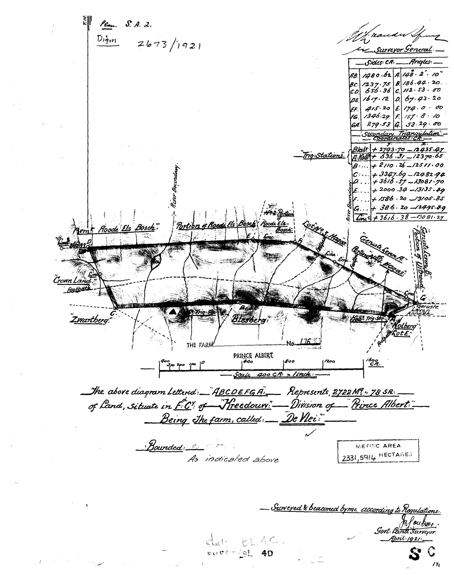
10069777 176 part 0.jpg.The record
- Type
- Surveyor-General diagram
- Diagram number
- 2673/1921
- Surveyed
- April 1921
- Titled
- 1921
- Surveyor
- J. Joubert
- Archive filename
- 10069777 176 part 0.jpg
Citation
- Title
- SG Dgm 2673/1921 - the farm De Vlei No. 176, Prince Albert
- Repository
- Landmeter-Generaal, Kaapstad
- Reference
- Plan S.A. 2; Dgm 2673/1921; surveyed and beaconed April 1921 by J. Joubert, Govt. Land Surveyor; scale 400 Cape Roods to 1 inch
- Type
- SG diagram
- Retrieved
- 2026-08-03
The ground it is about
De Vlei No. 176 176
Research notes
[SRC-216, read 3 Aug 2026; the reading is on PAR-000147] De Vlei No. 176, diagram 2673/1921, surveyed April 1921 in the FIELD CORNETCY OF KREEDOUW, division of Prince Albert. Extent 2722 morgen 78 square roods, with a later metric endorsement of 2331,5914 ha on the same sheet; the two agree to within 0,1% at the morgen factor, so the endorsement is a conversion and not a resurvey. Bounded by Roode Els Bosch, HAGAS, UITNOOD, Kolberg and Crown Land.
The research behind this page, kept separate from it: dated working notes, open questions, and what is not yet settled.