Surveyor-General diagram, B 358/1833, August 1833
Surveyor-General diagram, August 1833
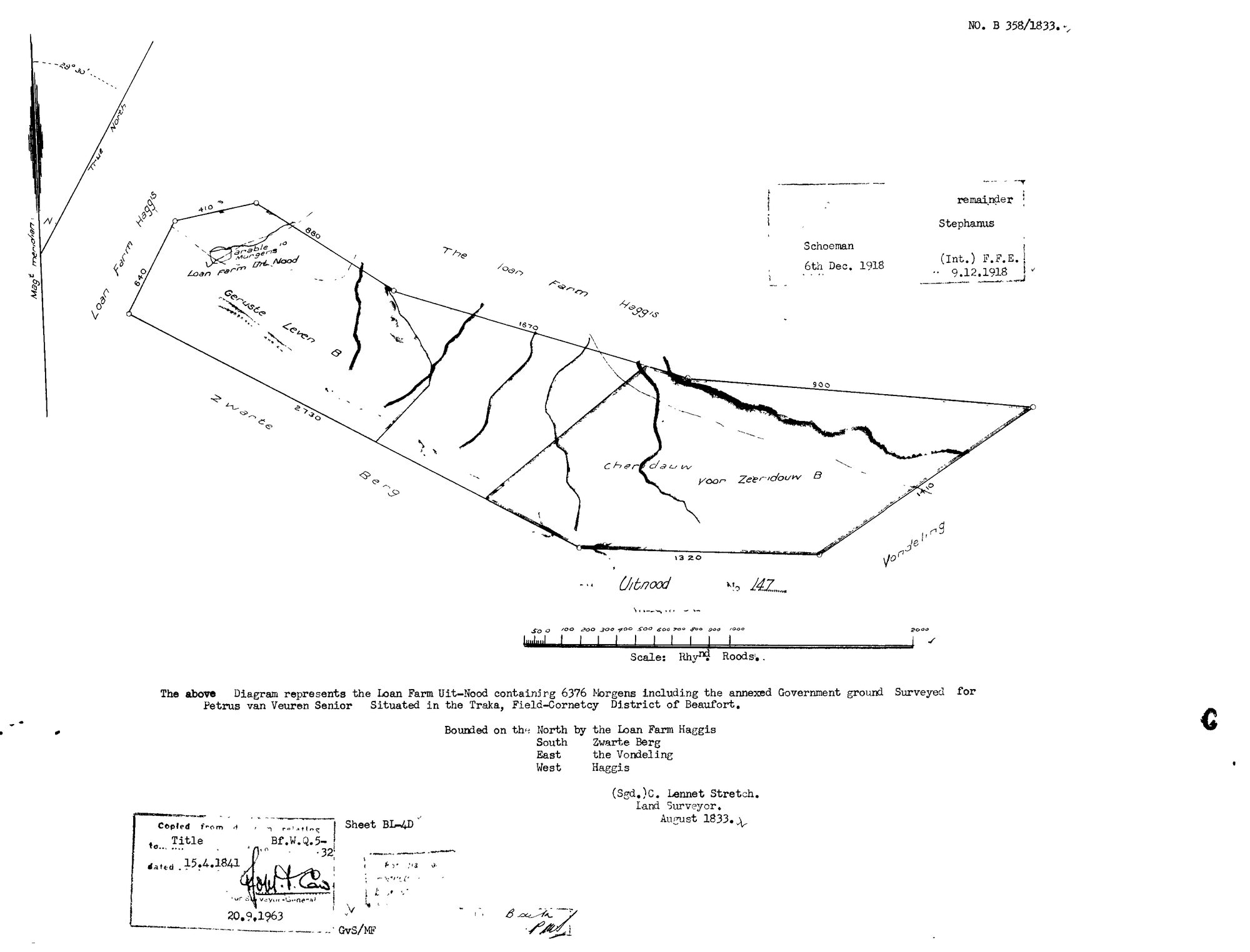
SCAN923.jpg.The record
- Type
- Surveyor-General diagram
- Diagram number
- B 358/1833
- Surveyed
- August 1833
- Titled
- 15 April 1841
- Deed
- Bf.W.Q.5-32
- Surveyor
- C.L. Stretch
- Archive filename
- SCAN923.jpg
Citation
- Title
- Uitnood No. 147 diagram and reverse, 1833
- Repository
- Surveyor-General
- Reference
- SG Dgm B 358/1833
- Type
- SG diagram
- Retrieved
- 2026-08-01
The ground it is about
Uitnood No. 147 (Loan Farm Uit-Nood)
Research notes
"The above Diagram represents the Loan Farm Uit-Nood containing 6376 Morgens including the annexed Government ground Surveyed for Petrus van Veuren SeniorM Situated in the Traka, Field-Cornetcy District of Beaufort." Bounded N by the Loan Farm Haggis, S Zwarte Berg, E the Vondeling, W Haggis. Signed C. Lennet Stretch [sic, for Lennox], Land Surveyor, August 1833. "Copied from diagram relating to Title Bf.W.Q.5-32 dated 15.4.1841", re-stamped 20.9.1963. Sheet BL-4D. Endorsed "Schoeman 6th Dec. 1918" and "remainder Stephanus (Int.) F.F.E. 9.12.1918". Named on the face: Geruste Leven B, Cheridauw voor Zeeridouw B, an arable of 10 Morgens, and the Loan Farm Uit Nood. THE SPELLING 'CHERIDAUW VOOR ZEERIDOUW' is a further variant of the Kredouw / Kriedouw name that the 1935 Vrolykheid portion diagrams show replacing Traka as the ward name; here in 1833 it is a place on the farm, not a ward. Same day and surveyor as Oorlogs Kloof No. 172 (DOC-0073), whose grantee Lucas van VeurenM is recorded as "P. Zoon".
The research behind this page, kept separate from it: dated working notes, open questions, and what is not yet settled.