Surveyor-General diagram, 353/1834, 1834
Surveyor-General diagram, 1834
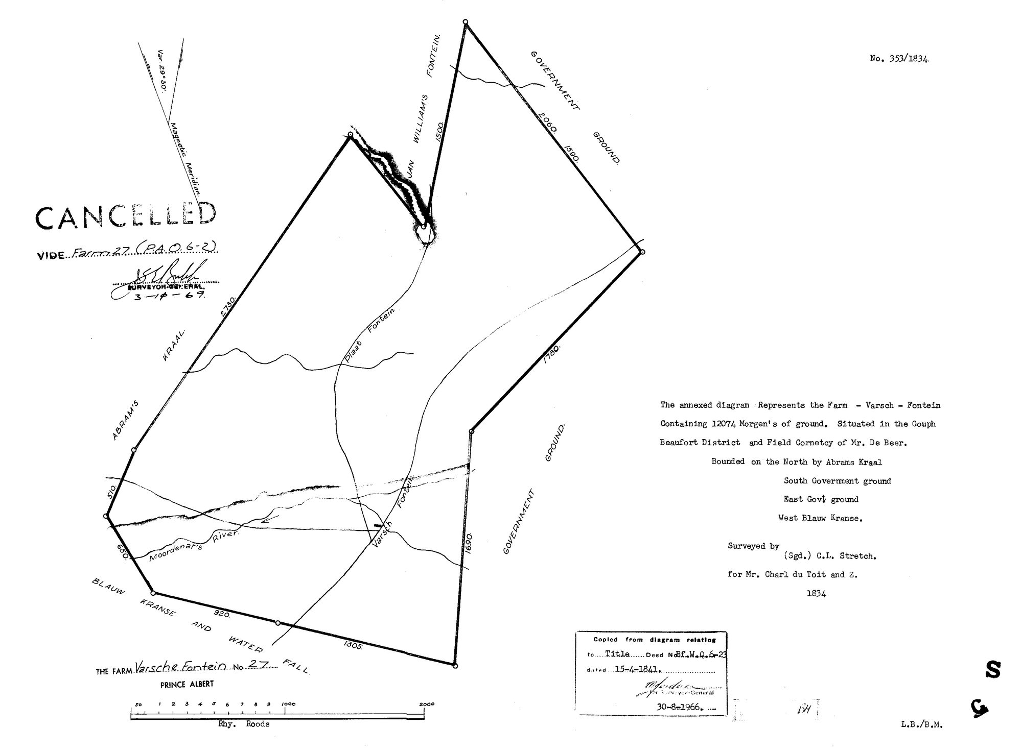
SCAN208 (3).TIF.The record
- Type
- Surveyor-General diagram
- Diagram number
- 353/1834
- Surveyed
- 1834
- Titled
- 15 April 1841
- Deed
- Bf.W.Q.6-23
- Surveyor
- C.L. Stretch
- Archive filename
- SCAN208 (3).TIF
Citation
- Title
- Varsche Fontein No.27 original grant diagram (1834)
- Repository
- Surveyor-General / Deeds e-portal
- Reference
- SG Dgm 353/1834
- Type
- SG diagram
The ground it is about
Research notes
ORIGINAL grant diagram. 12074 morgen. Gouph, Beaufort District, Field Cornetcy of Mr De Beer. Surveyed for "Mr Charl du ToitM and Z."; CANCELLED 1969 vide Farm 27 (P.A.Q.6-2). Copied from title diagram 30-8-1966. [29 Jul 2026] A second, full-colour scan of this same diagram arrived via the inbox as "11570527 (2).PDF" - confirmed identical (same SG Dgm No.353/1834, same 12074 morgen, same Charl du ToitM and Z., same C.L. Stretch survey, same CANCELLED/vide Farm 27 stamp, same 30-8-1966 copy note) against the existing TIFF. Filed alongside as sources/diagrams/DOC-0004-varschefontein-no27-original-1834-color.pdf; noticeably more legible and a strong candidate for the public-facing image if the site needs one.
The research behind this page, kept separate from it: dated working notes, open questions, and what is not yet settled.