Surveyor-General diagram, No.2 1903 (CL-7), April 1897
Surveyor-General diagram, April 1897
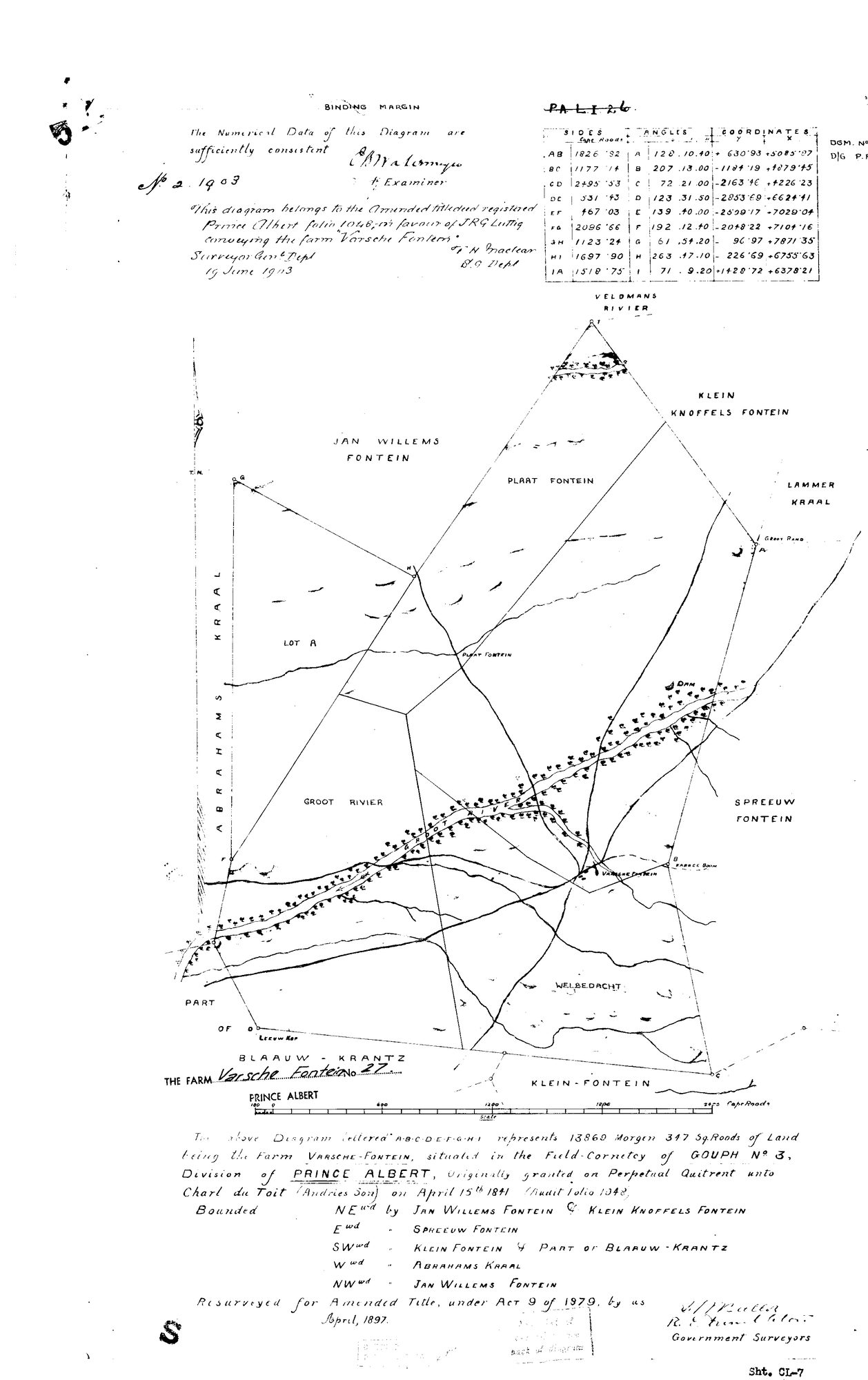
11046771.TIF.The record
- Type
- Surveyor-General diagram
- Diagram number
- No.2 1903 (CL-7)
- Surveyed
- April 1897
- Titled
- 19 June 1903
- Deed
- PA folio 1048
- Surveyor
- Government Surveyors (sgd)
- Examiner
- Watermeyer (examiner); F.H. Maclear, B.G. Dept
- Archive filename
- 11046771.TIF
Citation
- Title
- Varsche Fontein No.27 diagram
- Repository
- Surveyor-General
- Reference
- No.2 1903 / PA folio 1048
- Type
- SG diagram
The ground it is about
Research notes
Resurvey for Amended Title under Act 9 of 1879, April 1897; amended title registered Prince Albert folio 1048 in favour of J.R.G. LuttigM, 19 June 1903. 13869 mg 347 sq rds. Field-Cornetcy of Gouph No.3. Sheet CL-7 / PALI 26. Shows Lot A, Groot Rivier, Plaat Fontein and Welbedacht already drawn as internal divisions. Verso = DOC-0005. [29 Jul 2026] A second, full-colour, hand-tinted scan of this same diagram arrived via the inbox as "11577993 (1).PDF" - confirmed the identical document (same DGM No.2/1903, same folio 1048/Luttig conveyance, same 13869 mg 347 sq rds total, same Sheet CL-7 reference, same internal Lot A/Groot Rivier/Plaat Fontein/Welbedacht labelling) against the existing black-and-white TIFF - no discrepancy once compared directly. Filed alongside as sources/diagrams/DOC-0002-varschefontein-no27-princealbert-1897-1903-color.pdf; noticeably more legible and a strong candidate for the public-facing image if the site needs one.
The research behind this page, kept separate from it: dated working notes, open questions, and what is not yet settled.