SG_plan, 877/1870, 1870
SG plan, 1870
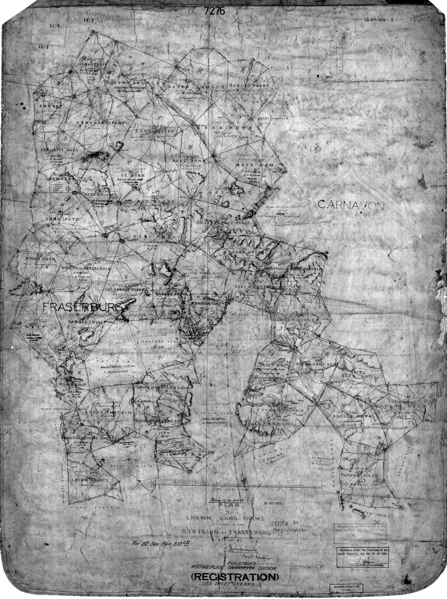
10136998 fraserburg.jpg.The record
- Type
- SG plan
- Diagram number
- 877/1870
- Surveyed
- 1870
- Archive filename
- 10136998 fraserburg.jpg
Citation
- Title
- SG 877/1870 - Plan of Crown Land Farms in the Division of Fraserburg (noting plan, registration)
- Repository
- Surveyor-General, Cape Town (Western Cape)
- Reference
- SG 877/1870; noting plan, Deg sheet EK.8 DK.2; folios 17, 18, 19 & 20; registration 2074/55
- Type
- SG_plan
- Retrieved
- 2026-08-11
Research notes
NOTING PLAN OF CROWN LAND FARMS, DIVISION OF FRASERBURG (with Carnarvon), SG 877/1870. THIS ANSWERS THE BISSIES QUESTION AS FAR AS THE PAPER CAN. BISSIES EN ANTEELKOLK is drawn on it with every one of its six recorded boundary names around it: KWAAI PUTS and ZAND PUTS to the north-west and north, WATER KLOOF and RIET POORT to the north-east, VAN RENENS PLAATS to the south-east, DASSIE KLOOF to the south - and the FRASERBURG town label lies immediately south-west of it. Other farms legible on the sheet include Lynx Leegte, Lynx Kolk, Boter Heegte, Schietpoort, Onrest, Verdriet Font., Vendutie Kolk, Zout Rivier, Brak Puts, Meys Dam, De Hoek, Rooi Zand, Losberg, Groot Hardekloof, Blaauw Heuvel, Bitterfontein, Rooi Kolk, Tamboer Fontein, Witte Fontein, Rooi Vley, Zoete Font., Scorpioens Drift, Kalk Gat, Klip Kolk, Drooge Puts, Tyger Fontein, Winkelhaak, Groot Fontein, Klein Meesters Kip, Moordenaars Gat, Leeuw Krantz, Zak Fontein, Tuins Kloof, Dassie Kloof and Karree Doorn. A POOR PHOTOSTAT: the small annotations beside most farms are dates and grantee names and are largely ILLEGIBLE at this resolution; they are not transcribed and must not be guessed.
The research behind this page, kept separate from it: dated working notes, open questions, and what is not yet settled.