Surveyor-General diagram, 128/1823, 15 May 1823
Surveyor-General diagram, 15 May 1823
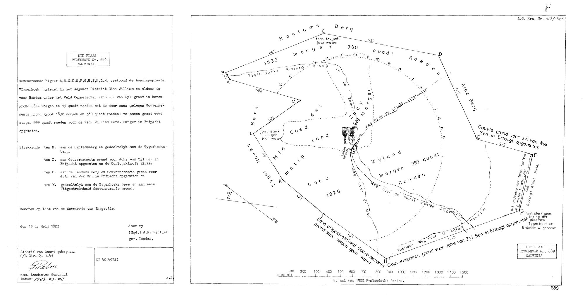
10018592 689 0.jpg.The record
- Type
- Surveyor-General diagram
- Diagram number
- 128/1823
- Surveyed
- 15 May 1823
- Surveyor
- J.M. Wentzel
- Archive filename
- 10018592 689 0.jpg
Citation
- Title
- L.G. Kaart 128/1823: die plaas TYGERHOEK No. 689, Calvinia - the 1823 loan-farm survey
- Repository
- Surveyor-General. Supplied by Frans to _inboxas '10018592 689 0.jpg'.
- Reference
- L.G. Krt. Nr. 128/1823. Afschrift van kaart geheg aan G/B Clv. Q. 1-41. DI-4C(4972). Copy certified nms. Landmeter Generaal, 1983-03-02.
- Type
- SG diagram
- Retrieved
- 2026-08-10
The ground it is about
Research notes
Filed 10 Aug 2026 from _inbox. Full transcription on SRC-359.
The research behind this page, kept separate from it: dated working notes, open questions, and what is not yet settled.