Surveyor-General diagram, 354/1834, 1834
Surveyor-General diagram, 1834
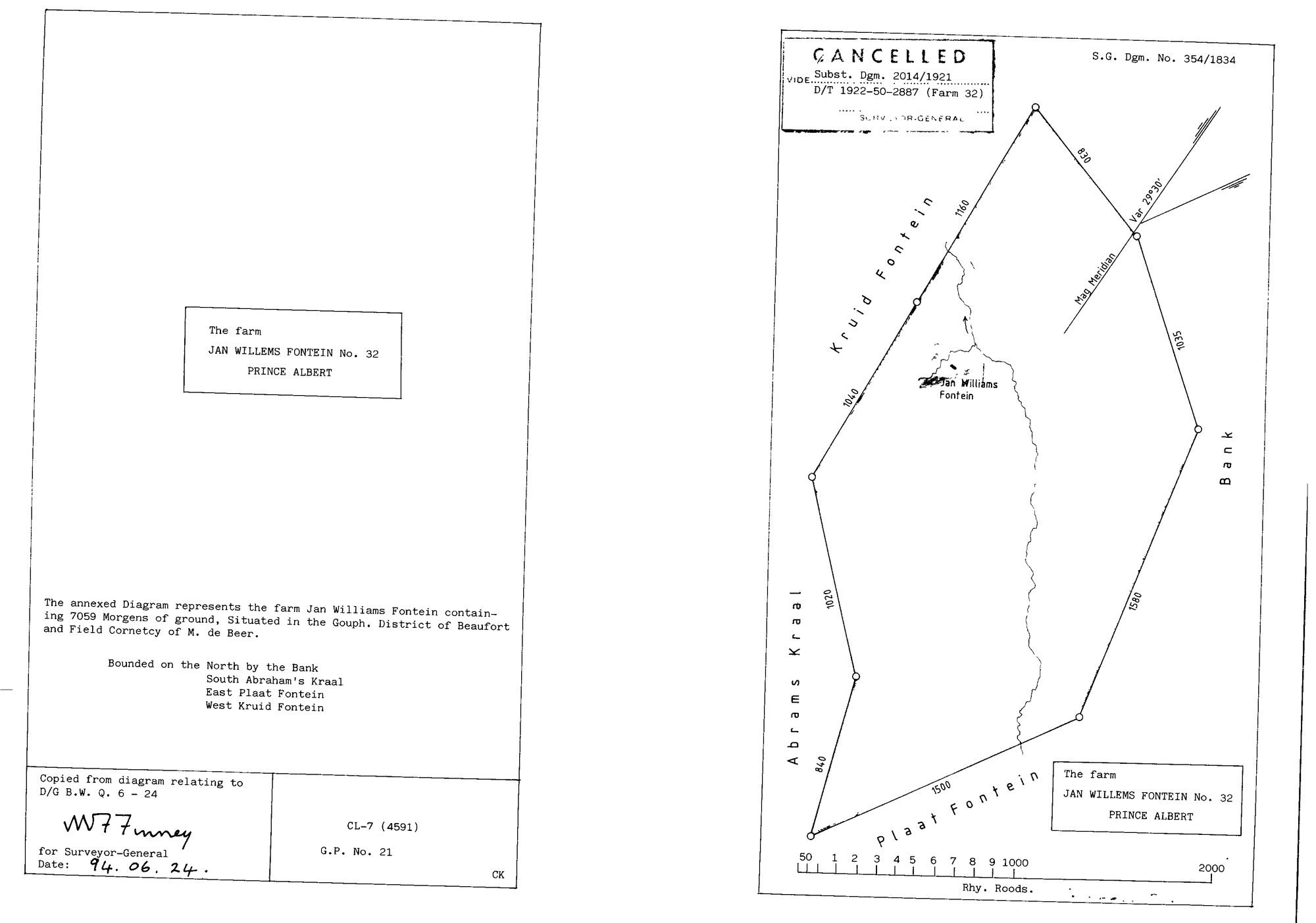
10TRQ701 32 0.jpg.The record
- Type
- Surveyor-General diagram
- Diagram number
- 354/1834
- Surveyed
- 1834
- Deed
- B.W. Q. 6-24
- Archive filename
- 10TRQ701 32 0.jpg
Citation
- Title
- S.G. Diagram 354/1834: the farm Jan Willems Fontein No. 32, Prince Albert (7,059 morgen), CANCELLED
- Repository
- Surveyor-General, Cape Town. Supplied by Frans to _inboxas '10TRQ701 32 0.jpg'.
- Reference
- S.G. Dgm. No. 354/1834. Copy sheet CL-7 (4591), G.P. No. 21, signed for the Surveyor-General 24 June 1994. Original grant reference given on the sheet as 'D/G B.W. Q. 6 - 24'.
- Type
- SG diagram
- Retrieved
- 2026-08-09
The ground it is about
Research notes
THE FIRST DOCUMENT THIS FARM HAS EVER HAD. PAR-000126 was created on 1 Aug 2026 out of six neighbour mentions and a cadastral polygon, with a standing [TO VERIFY] on 'its number, extent and holders against a diagram'. This is that diagram and it settles two of the three. EXTENT 7,059 MORGEN, about 6,046 ha. DISTRICT OF BEAUFORT in 1834, Field Cornetcy of M. de BeerM, 'Situated in the Gouph'. The title block on the 1994 copy says PRINCE ALBERT, which is the modern division. The sheet therefore carries the administrative move in one place, and it is the ordinary one for this district: Beaufort West administered the Koup until Prince Albert was founded. NO HOLDER IS NAMED, so the third part of that [TO VERIFY] stays open. image_edtf is the 1994 copy date and not the content, per 11a: a 1994 photostat of an 1834 diagram is an 1834 diagram. The latest thing written on the sheet is the cancellation, 1921/1922.
The research behind this page, kept separate from it: dated working notes, open questions, and what is not yet settled.