Diagram verso, 765/1873 (verso), 1872
Diagram verso, 1872
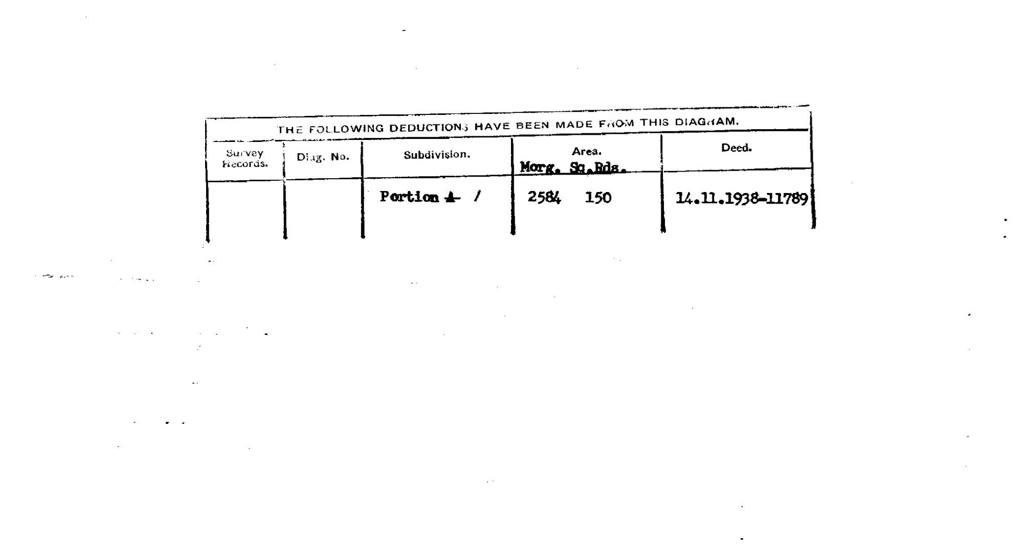
10FKU801 16 0.jpg.The record
- Type
- Diagram verso
- Diagram number
- 765/1873 (verso)
- Surveyed
- 1872
- Titled
- 1938
- Archive filename
- 10FKU801 16 0.jpg
Citation
- Title
- The farm Wit Poortje No. 16, Prince Albert - SG diagram 765/1873 and its verso deduction table
- Repository
- Surveyor-General, Cape Town (via the Chief Surveyor-General's e-SIO)
- Reference
- SG 765/1873; Title Deed P.A.Q.2-26 of 1 July 1879; Sht. CL-8
- Type
- survey diagram
- Retrieved
- 2026-08-09
The ground it is about
Research notes
[9 Aug 2026] READ. "THE FOLLOWING DEDUCTIONS HAVE BEEN MADE FROM THIS DIAGRAM." One row and nothing else, columns Survey Records
Diag. No.
Subdivision
Area (Morg., Sq. Rds.)
Deed: [blank]
[blank]
"Portion A" with the A struck through and 1 written in
2584
150
14.11.1938 - 11789.
THE FARM WAS HALVED TO THE SQUARE ROOD. 5,168 morgen 300 roods less 2,584 morgen 150 roods leaves 2,584 morgen 150 roods. The two pieces are identical. See PAR-000183.
survey_edtf carries the FRONT's survey year and title_edtf the newest endorsement, 1938, which is the handling used for every verso here. That withholds the image on date; publish_ok releases it, because the sheet has been read and NAMES NOBODY - a portion letter, an area and a deed number. 11: the gate is about people and a deduction table is about ground.
The research behind this page, kept separate from it: dated working notes, open questions, and what is not yet settled.