Surveyor-General diagram, 2115/1912, July 1912
Surveyor-General diagram, July 1912
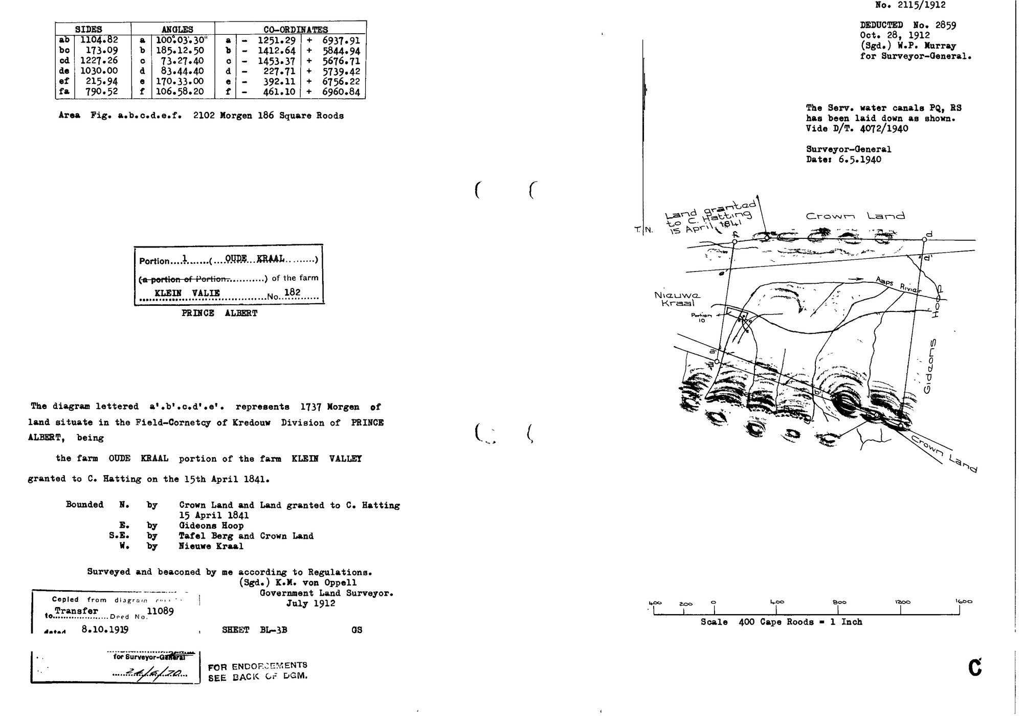
10TVUM01.jpg.The record
- Type
- Surveyor-General diagram
- Diagram number
- 2115/1912
- Surveyed
- July 1912
- Titled
- 8 October 1919
- Archive filename
- 10TVUM01.jpg
Citation
- Title
- 2115/1912, Klein Valie No. 182, Prince Albert
- Repository
- Surveyor-General, Cape Town (SGCTN)
- Reference
- 2115/1912
- Type
- SG_diagram
- Retrieved
- 2026-08-05
The ground it is about
Oude Kraal (Klein Valie No. 182 Ptn 1) 1/182
Research notes
[5 Aug 2026 inbox] Portion 1 OUDE KRAAL, 1737 morgen, Field-Cornetcy of Kredouw, Division Prince Albert. Surveyed and beaconed by K.M. von OppellM, July 1912. Whole figure a.b.c.d.e.f = 2102 mg 186 sq rds; the portion a'.b'.c.d'.e' = 1737 mg. Bounded N by Crown Land and land granted to C. HattingM 15 April 1841; E by Gideons Hoop; SE by Tafel Berg and Crown Land; W by Nieuwe Kraal. Portion 10 and the Aaps Rivier are drawn on the face. Deducted No. 2859, 28 Oct 1912, sgd W.P. Murray for Surveyor-General. Copied from the diagram relating to Transfer deed 11089 dated 8.10.1919, sheet BL-3B. publish_ok=yes: the only post-1936 ink is the Surveyor-General's servitude endorsement of 6.5.1940 ('the Serv. water canals PQ, RS has been laid down as shown. Vide D/T 4072/1940'). Sheet read in full; it names no living person.
The research behind this page, kept separate from it: dated working notes, open questions, and what is not yet settled.