Surveyor-General diagram, 523/1839, 1839
Surveyor-General diagram, 1839
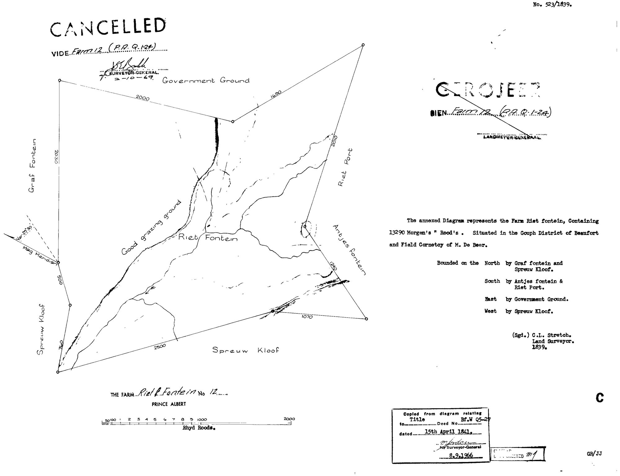
SCAN164 12 0.jpg.The record
- Type
- Surveyor-General diagram
- Diagram number
- 523/1839
- Surveyed
- 1839
- Titled
- 15 April 1841
- Deed
- Bf.W.Q. 5-27
- Surveyor
- C. Lennox Stretch
- Archive filename
- SCAN164 12 0.jpg
Citation
- Title
- SG Dgm 523/1839 - the farm Riet Fontein No. 12, Prince Albert
- Repository
- Landmeter-Generaal, Kaapstad
- Reference
- No. 523/1839; C.L. Stretch, Land Surveyor, 1839; title Bf.W.Q. 5-27 of 15 April 1841; copied 8 September 1966; CANCELLED 2 October 1969, vide Farm 12 (P.A.Q. 1-24)
- Type
- SG diagram
- Retrieved
- 2026-08-04
The ground it is about
Research notes
Cancelled 2 Oct 1969 vide Farm 12 (P.A.Q. 1-24).
[8 Aug 2026, read] SG 523/1839, C. L. STRETCH, Land Surveyor, 1839. 'The annexed Diagram represents the FARM RIET FONTEIN, Containing 13290 Morgen's. Situated in the GOUPH DISTRICT OF BEAUFORT and FIELD CORNETCY OF M. DE BEER.' Bounded N Graf fontein and Spreeuw Kloof, S Antjes fontein & Riet Port, E Government Ground, W Spreeuw Kloof. Across the figure, along the watercourse, the surveyor has written 'GOOD GRAZING GROUND' - a judgement about the land in his own hand, which is rare on these sheets. Copied from the diagram to title Bf.W Q5-27 of 15 APRIL 1841 - the fourth farm in this project now shown to be titled that day - and stamped 8 Sept 1966. CANCELLED vide Farm 12 (P.A.Q.1-24) by the Surveyor-General on 2 Oct 1969, and separately GEROJEER (geroyeer) by the Landmeter-Generaal. Same ward as the Waterfall sheet, DOC-0220.
The research behind this page, kept separate from it: dated working notes, open questions, and what is not yet settled.