Surveyor-General diagram, 350/1833, August 1833
Surveyor-General diagram, August 1833
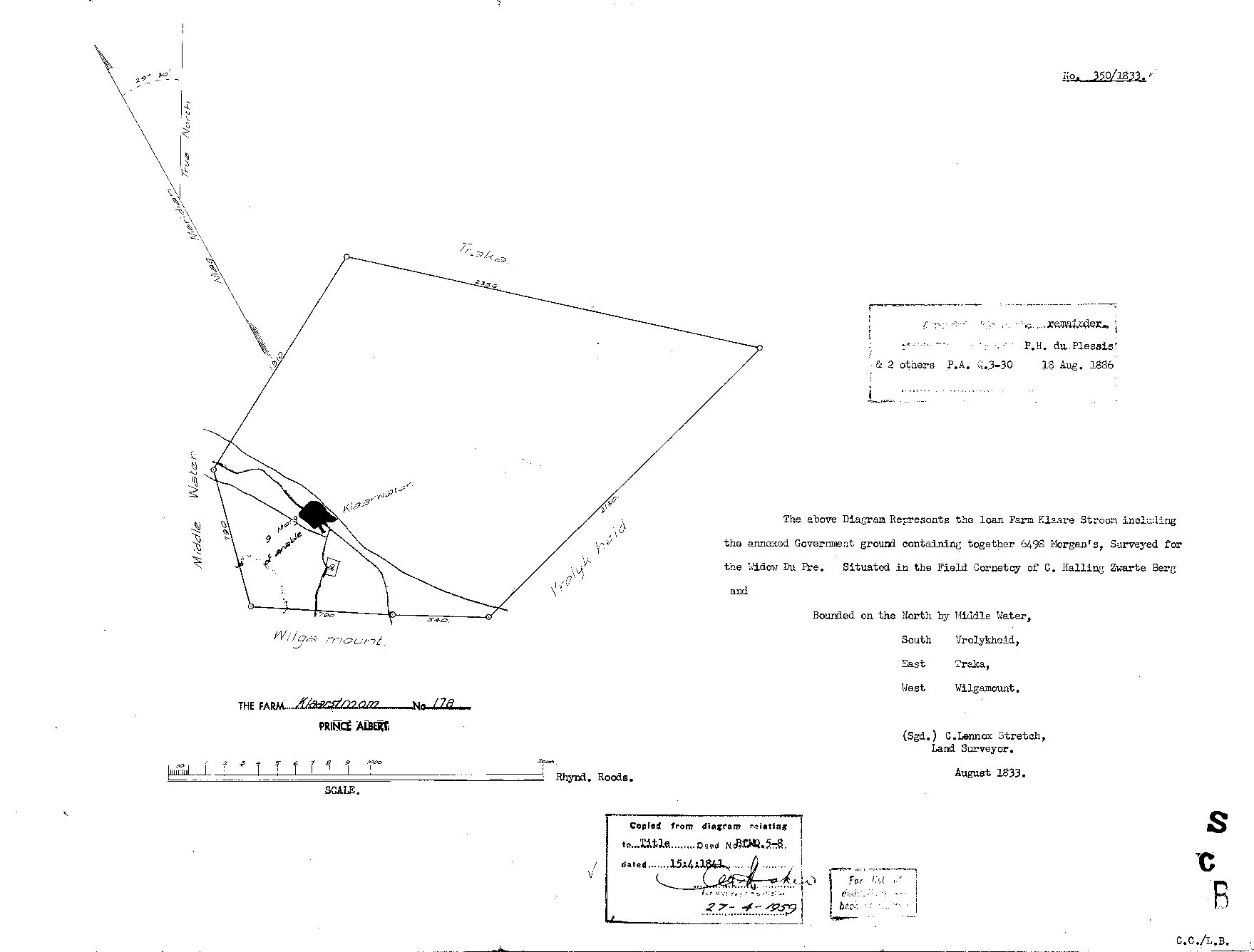
10259556 178 0.jpg.The record
- Type
- Surveyor-General diagram
- Diagram number
- 350/1833
- Surveyed
- August 1833
- Titled
- 15 April 1841
- Deed
- P.A.Q. 5-8; earlier P.A. Q.3-30 of 18.8.1836
- Surveyor
- C. Lennox Stretch
- Archive filename
- 10259556 178 0.jpg
Citation
- Title
- SG Dgm 350/1833 - the loan farm Klaare Stroom, later Klaarstroom No. 178, Prince Albert
- Repository
- Landmeter-Generaal, Kaapstad
- Reference
- No. 350/1833; surveyed August 1833 by C. Lennox Stretch, Land Surveyor; copied from the diagram relating to Title Deed No. P.A.Q. 5-8 dated 15.4.1841; endorsed 27-4-1959; scale in Rhynland Roods
- Type
- SG diagram
- Retrieved
- 2026-08-03
The ground it is about
De Claar Stroom (Klaarstroom No. 178) 178
Research notes
[8 Aug 2026, read] SG 350/1833, signed C. LENNOX STRETCH, Land Surveyor, August 1833. 'The above Diagram Represents the loan Farm KLAARE STROOM including the annexed Government ground containing together 6498 Morgen's, Surveyed for THE WIDOW DU PRE. Situated in the FIELD CORNETCY OF C. HALLING ZWARTE BERG.' Bounded N Middle Water, S Vrolykheid, E TREKA, W Wilgamount. NINE MORGEN OF ARABLE LAND is marked at the werf, on the Klaarwater. Copied from the diagram to title deed P.A.Q.5-8 of 15 APRIL 1841 - the grant day - and the copy stamped 27 April 1959, which is the only reason this sheet was being withheld. A later endorsement gives the Remainder to P.H. du PlessisM & 2 others, P.A. Q.3-30, 18 Aug 1886. TWO THINGS WORTH CARRYING AWAY: the farm was held by a widow eight years before the grant, and TREKA IS THE EASTERN NEIGHBOUR here - a place on the ground, not only the ward name that LEAD-0014 turns on.
The research behind this page, kept separate from it: dated working notes, open questions, and what is not yet settled.