Surveyor-General diagram, 88/1900, March 1899
Surveyor-General diagram, March 1899
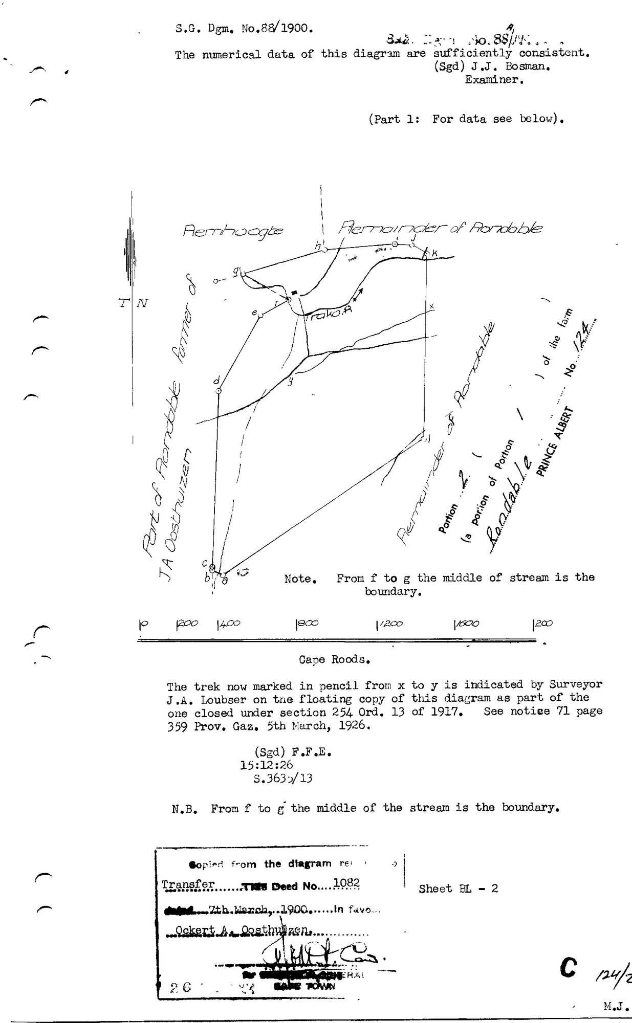
10TSV901 124 2.jpg.The record
- Type
- Surveyor-General diagram
- Diagram number
- 88/1900
- Surveyed
- March 1899
- Titled
- 7 March 1900
- Deed
- Transfer 1082 of 7.3.1900
- Surveyor
- H.J. Lustig
- Examiner
- J.J. Bosman
- Archive filename
- 10TSV901 124 2.jpg
Citation
- Title
- SG Dgm 88/1900 - Portion 2 (a portion of Portion 1) of the farm Rondable No. 124
- Repository
- Landmeter-Generaal, Kaapstad
- Reference
- S.G. Dgm. No. 88/1900, Part 1; examiner J.J. Bosman; copied from the diagram relating to Transfer Deed No. 1082 dated 7th March 1900; Sheet BL-2
- Type
- SG diagram
- Retrieved
- 2026-08-03
The ground it is about
Visgat (Rondabel No. 124 Ptn 2) 2/124
Research notes
[5 Aug 2026] This row used to list 2 filenames under one id, which made every sheet after the first unreachable - see 8. The others (10TSVB01 124 2.jpg) were re-pulled and now have their own rows: DOC-0242. LEAD-0095 closed.
The research behind this page, kept separate from it: dated working notes, open questions, and what is not yet settled.