Diagram verso, B.352/1833 (verso), 1833
Diagram verso, 1833
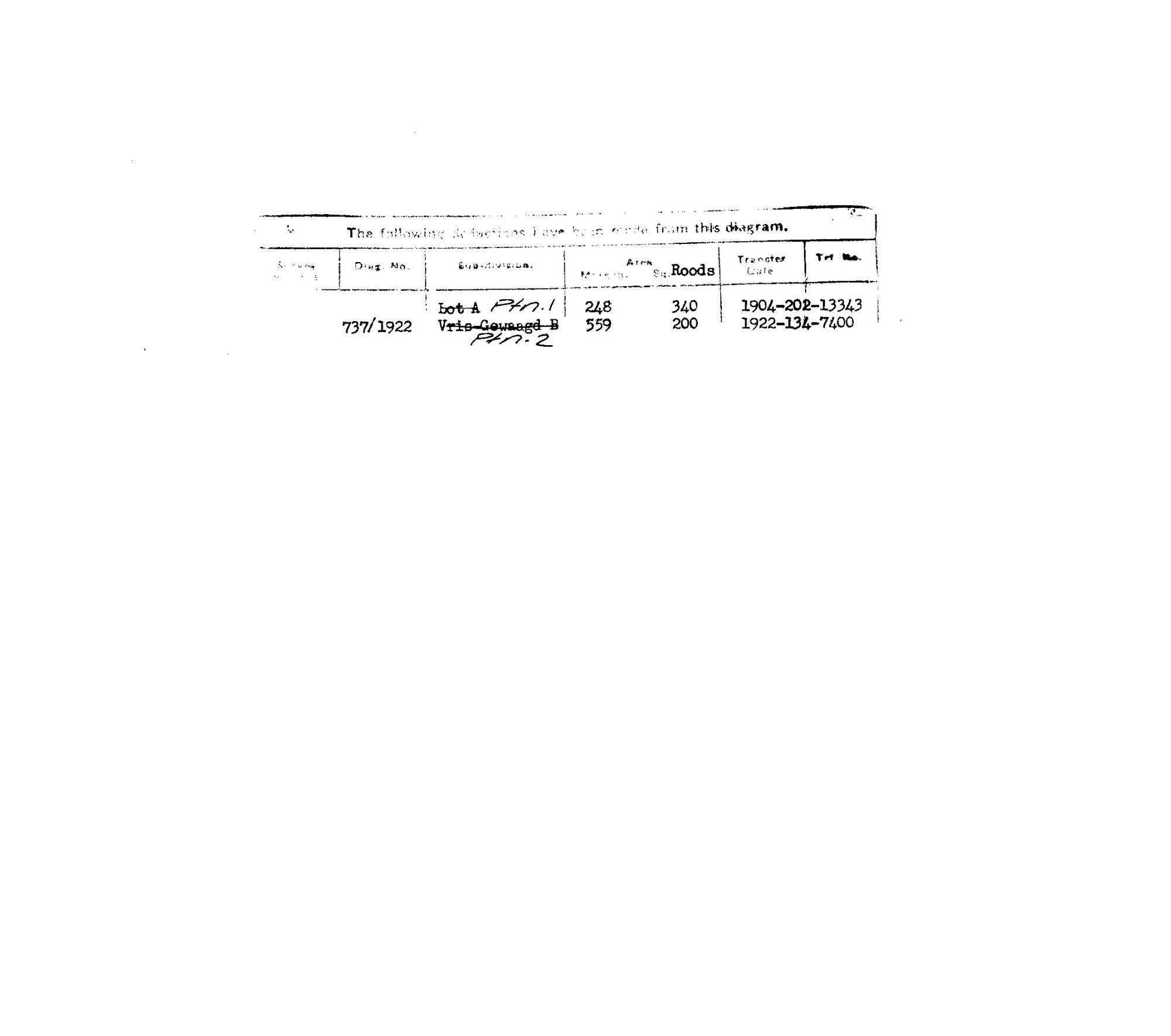
10OUR501 vrisch 2.jpg.The record
- Type
- Diagram verso
- Diagram number
- B.352/1833 (verso)
- Archive filename
- 10OUR501 vrisch 2.jpg
Citation
- Title
- SG Dgm B.352/1833 - the Government ground Versch Gewagt (Vrisch Gewagt No. 163), Prince Albert, with its deduction verso
- Repository
- Surveyor-General, Cape Town
- Reference
- SG Dgm B.352/1833; title Bf.W.Q.5-11 of 15 Apr 1841; copied 21.6.1963
- Type
- SG diagram
- Retrieved
- 2026-08-02
The ground it is about
Research notes
"The following deductions have been made from this diagram." Ptn 1, the name LOT A struck through, 248 morgen 340 sq roods, transfer 1904-202-13343. Ptn 2, the name VRIS GEWAAGD B struck through, dgm 737/1922, 559 morgen 200 sq roods, transfer 1922-134-7400. BOTH NAMES ARE STRUCK AND REPLACED BY NUMBERS - the same thing that happened to 'Droege Kloof' on Bloemendal Annex's verso. The plan face carries the local name, the register replaces it with a number, and that is exactly how a werf name leaves the official record while staying in use on the ground. See 5.
The research behind this page, kept separate from it: dated working notes, open questions, and what is not yet settled.