Surveyor-General diagram, 3198 (1010 struck), March 1913
Surveyor-General diagram, March 1913
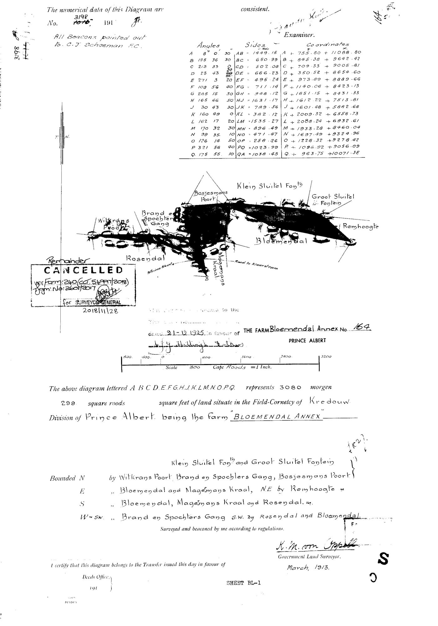
11559001 bloem annex.jpg.The record
- Type
- Surveyor-General diagram
- Diagram number
- 3198 (1010 struck)
- Surveyed
- March 1913
- Titled
- 21 December 1925
- Surveyor
- K.M. von Oppell
- Archive filename
- 11559001 bloem annex.jpg
Citation
- Title
- SG Dgm 3198 of 1913 - the farm Bloemendal Annex No. 164, Prince Albert, with its deduction verso
- Repository
- Surveyor-General, Cape Town
- Reference
- SG Dgm 3198 (1010 struck), 191[3]; Sheet BL-1
- Type
- SG diagram
- Retrieved
- 2026-08-02
The ground it is about
Research notes
"The above diagram lettered A B C D E F G H J K L M N O P Q represents 3080 morgen 299 square roods of land situate in the Field-Cornetcy of Kredouw, Division of Prince Albert, being the farm 'BLOEMENDAL ANNEX'." All beacons pointed out to C.J. SchoemanM, F.C. Closed traverse A-Q with angles, sides and Lo coordinates. CANCELLED 2018-11-28 vide Farm 240 (CCT 51997/2018), Dgm 2601/2017.
The research behind this page, kept separate from it: dated working notes, open questions, and what is not yet settled.