Surveyor-General diagram, 861/1873, 1873
Surveyor-General diagram, 1873
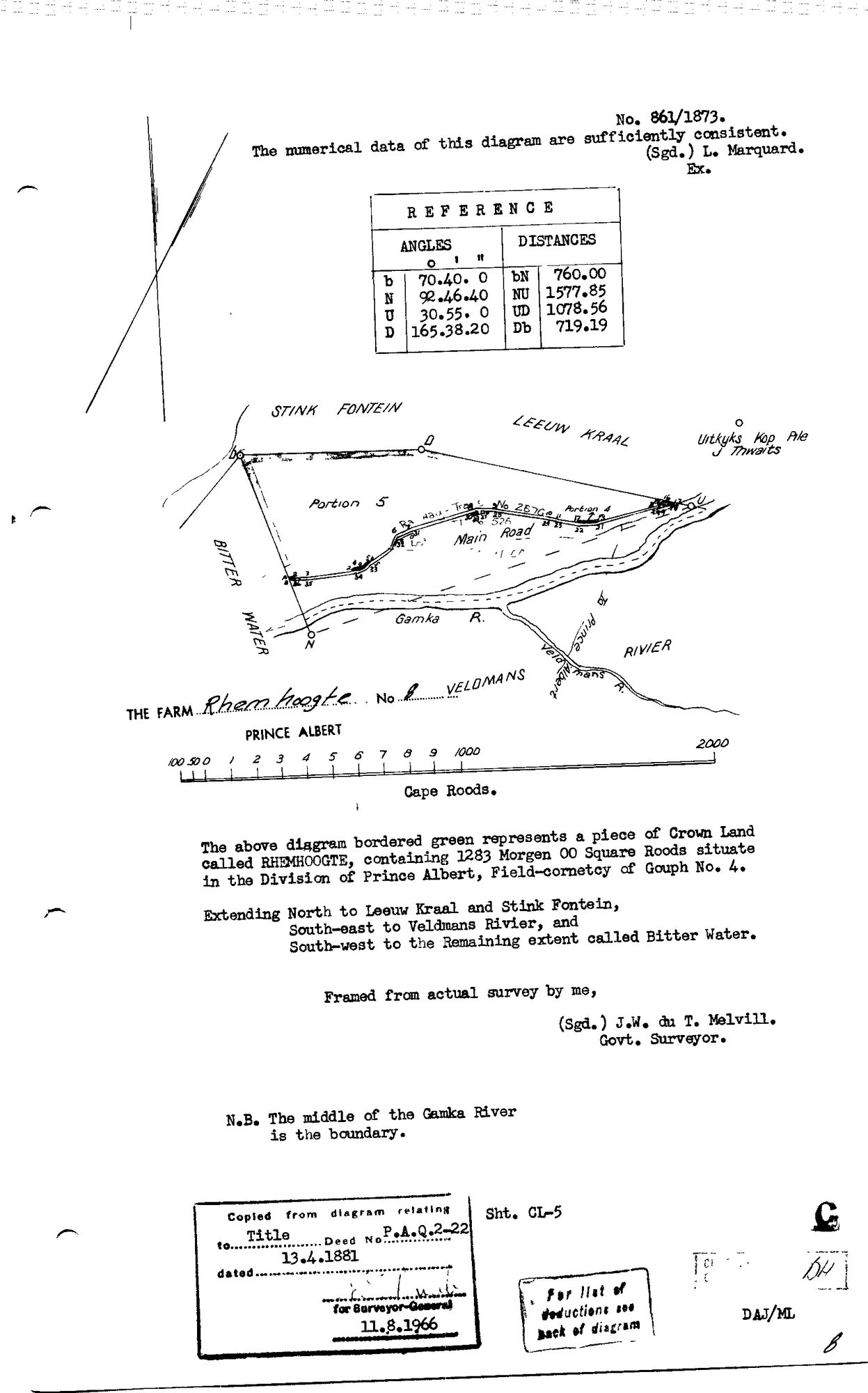
10TREZ01 Rhemhoogte 1873.jpg.The record
- Type
- Surveyor-General diagram
- Diagram number
- 861/1873
- Surveyed
- 1873
- Titled
- 13 April 1881
- Deed
- P.A.Q.2-22
- Surveyor
- J.W. du T. Melvill
- Examiner
- L. Marquard
- Archive filename
- 10TREZ01 Rhemhoogte 1873.jpg
Citation
- Title
- Rhemhoogte No.8 (Gouph) diagram, 1873
- Repository
- Surveyor-General
- Reference
- SG Dgm 861/1873
- Type
- SG diagram
Research notes
"A piece of Crown Land called RHEMHOOGTE, containing 1283 Morgen 00 Square Roods... Field-cornetcy of Gouph No. 4. Extending North to Leeuw Kraal and Stink Fontein, South-east to Veldmans Rivier, South-west to the Remaining extent called Bitter Water." Middle of the GAMKA River the boundary; Main Road and portions 4/5 marked. Title P.A.Q.2-22 dated 13.4.1881 (1966 copy-stamp). THE THIRD Remhoogte-named farm in the division - modern farm No.8 (cadastre 1,127 ha vs 1,283 mg = 1,098.9 ha, 2.5%) near Veldmans Rivier - NOT the core farm No.125 and NOT No.167. Filed without a parcel; namesake logged to prevent conflation (same discipline as DOC-0074 Tulbagh).
The research behind this page, kept separate from it: dated working notes, open questions, and what is not yet settled.