Surveyor-General diagram, 1177/1940, January 1940
Surveyor-General diagram, January 1940
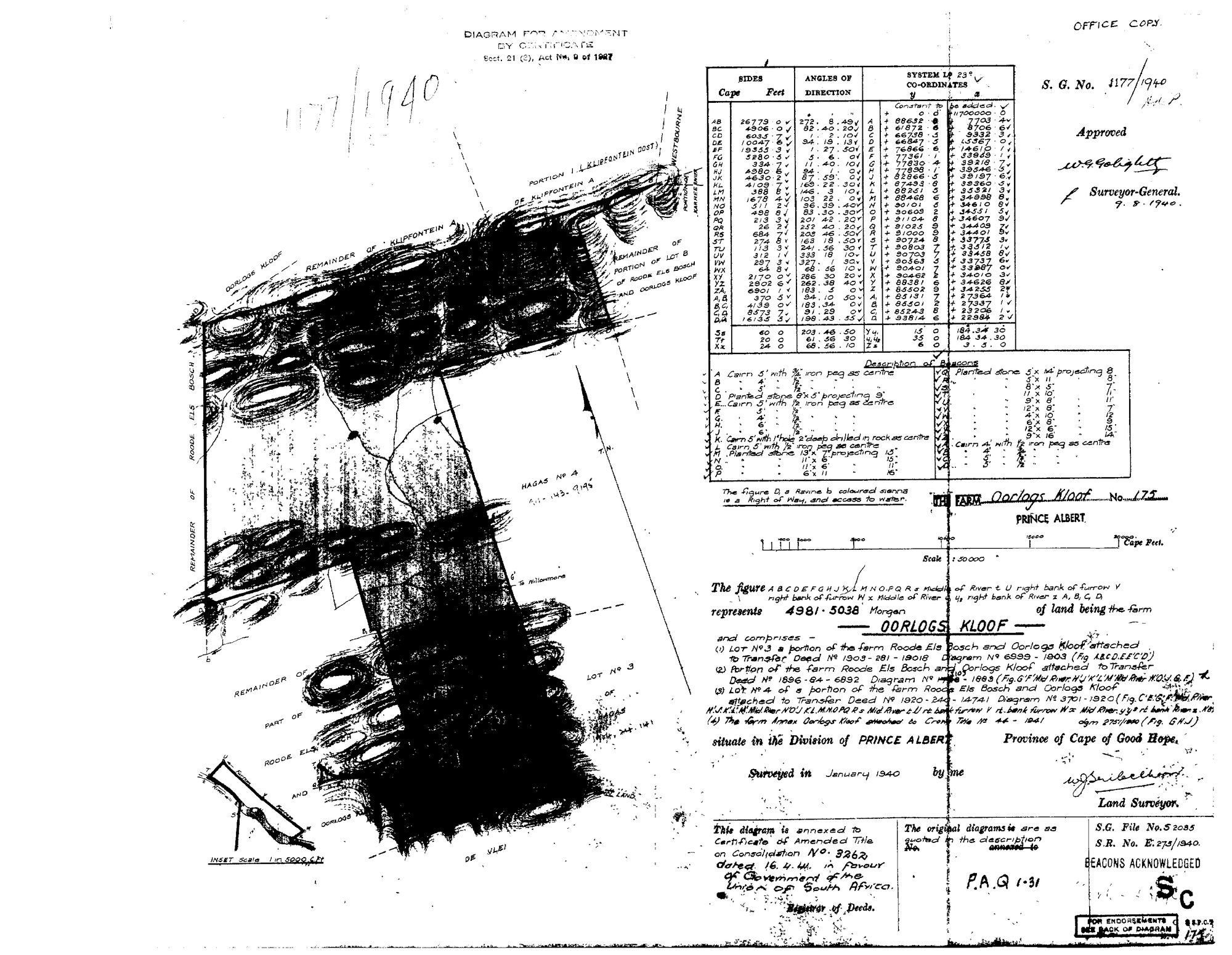
10JS4901.TIF.The record
- Type
- Surveyor-General diagram
- Diagram number
- 1177/1940
- Surveyed
- January 1940
- Titled
- 16 April 1941
- Deed
- 3262
- Surveyor
- W.J. Seibelhoff (signature, reading uncertain)
- Archive filename
- 10JS4901.TIF
Citation
- Title
- Oorlogs Kloof No.175 consolidation diagram, 1940
- Repository
- Surveyor-General
- Reference
- SG Dgm 1177/1940
- Type
- SG diagram
The ground it is about
Oorlogs Kloof No. 175 (1940 consolidation) 175
Research notes
"Diagram for Amendment by Certificate, Sect. 21(3), Act No. 9 of 1927." "The figure ... represents 4981.5038 Morgen of land being the farm OORLOGS KLOOF" No. 175, Prince Albert, "and comprises - (1) Lot No.3 a portion of the farm Roode Els Bosch and Oorlogs Kloof attached to Transfer Deed No 1903-281-19018, Diagram No 6999-1903; (2) Portion of the farm Roode Els Bosch and Oorlogs Kloof attached to Transfer Deed No 1896-84-6892, Diagram No [1103]-1893; (3) Lot No.4 of a portion of the farm Roode Els Bosch and Oorlogs Kloof attached to Transfer Deed No 1920-240-14741, Diagram No 3701-1920; (4) The farm Annex Oorlogs Kloof attached to Crown Title No 44-1941, dgm 2751/1940." Surveyed January 1940; approved 9.8.1940 (W.G. Golightly for Surveyor-General). "This diagram is annexed to Certificate of Amended Title on Consolidation No. 3262 dated 16.4.41 IN FAVOUR OF THE GOVERNMENT OF THE UNION OF SOUTH AFRICA." P.A.Q.1-31 quoted as the original title. S.G. File S2035, S.R. E.275/1940. Neighbours drawn: Oorlogs Kloof, Remainder of Klipfontein A, Portion 1 (Klipfontein Oost), Westbourne, Remainder of Roode Els Bosch, Remainder of Portion of Lot B of Roode Els Bosch and Oorlogs Kloof, Hagas No 4, De Vlei.
[3 Aug 2026] publish_ok=yes. This is an OLD FARM DIAGRAM held back only because a TRANSFER ENDORSEMENT on its face crosses the 1936 scan cut-off - the survey itself is from the 1920s or 1930s. The names on it are the surveyor, the neighbouring farms and a transferee of the 1930s or 1940, all long dead and most of them already published as person records here. Reviewed individually, not opened as a category.
The research behind this page, kept separate from it: dated working notes, open questions, and what is not yet settled.