Surveyor-General diagram, 1059/1871, November 1863
Surveyor-General diagram, November 1863
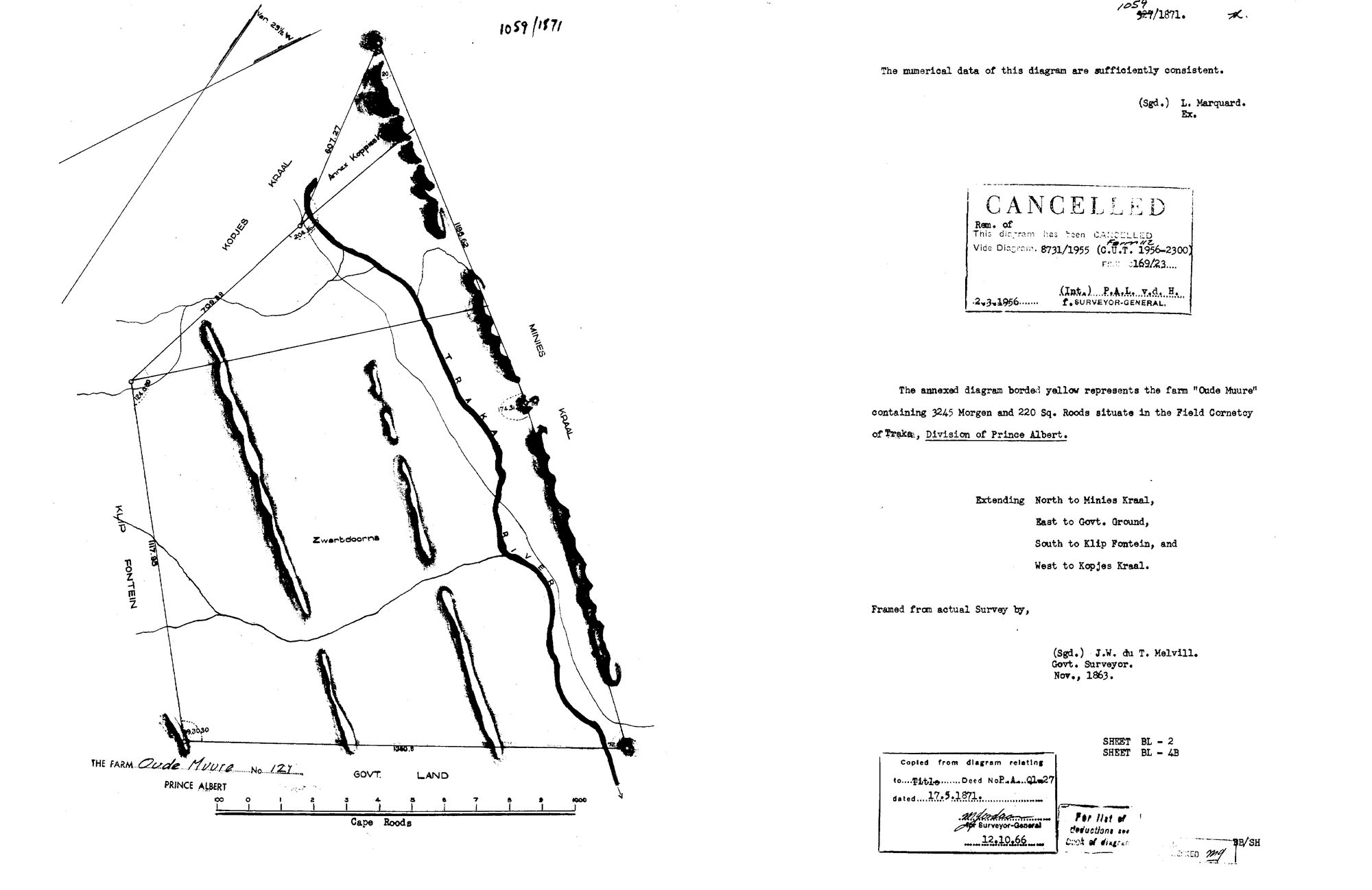
10OUNO01.TIF.The record
- Type
- Surveyor-General diagram
- Diagram number
- 1059/1871
- Surveyed
- November 1863
- Surveyor
- J.W. de T. Melvill
- Examiner
- L. Marquard
- Archive filename
- 10OUNO01.TIF
Citation
- Title
- Oude Muure No.121 diagram (1863 resurvey)
- Repository
- Surveyor-General
- Reference
- SG Dgm 1059/1871
- Type
- SG diagram
The ground it is about
Oude Muure 121
Research notes
"The annexed diagram borded yellow represents the farm 'Oude Muure' containing 3245 Morgen and 220 Sq. Roods situate in the Field Cornetcy of Traka, Division of Prince Albert. Extending North to Minies Kraal, East to Govt. Ground, South to Klip Fontein, and West to Kopjes Kraal." Framed from actual survey by J.W. du T. MelvillM, Nov 1863; title P.A.Q.1-27 dated 17.5.1871. [CORRECTED 29 Jul 2026] Extent is 3245 morgen 220 sq roods - 85 morgen LESS than the 1859 survey's 3330, not "3410/80 more" as first transcribed. CANCELLED stamp, 2.3.1956: the Remainder re-titled vide Diagram 8731/1955 under C.U.T. 1956-2300 into the new FARM 112 - which is why farm 121 survives in the modern cadastre only as an 84.7 ha remainder and the 101.2 ha triangle Ptn 2 (see PAR-000029/PAR-000046). Traka River runs through the eastern side; internal name Zwartdoorns.
The research behind this page, kept separate from it: dated working notes, open questions, and what is not yet settled.