Surveyor-General diagram, 1919
Surveyor-General diagram, 1919
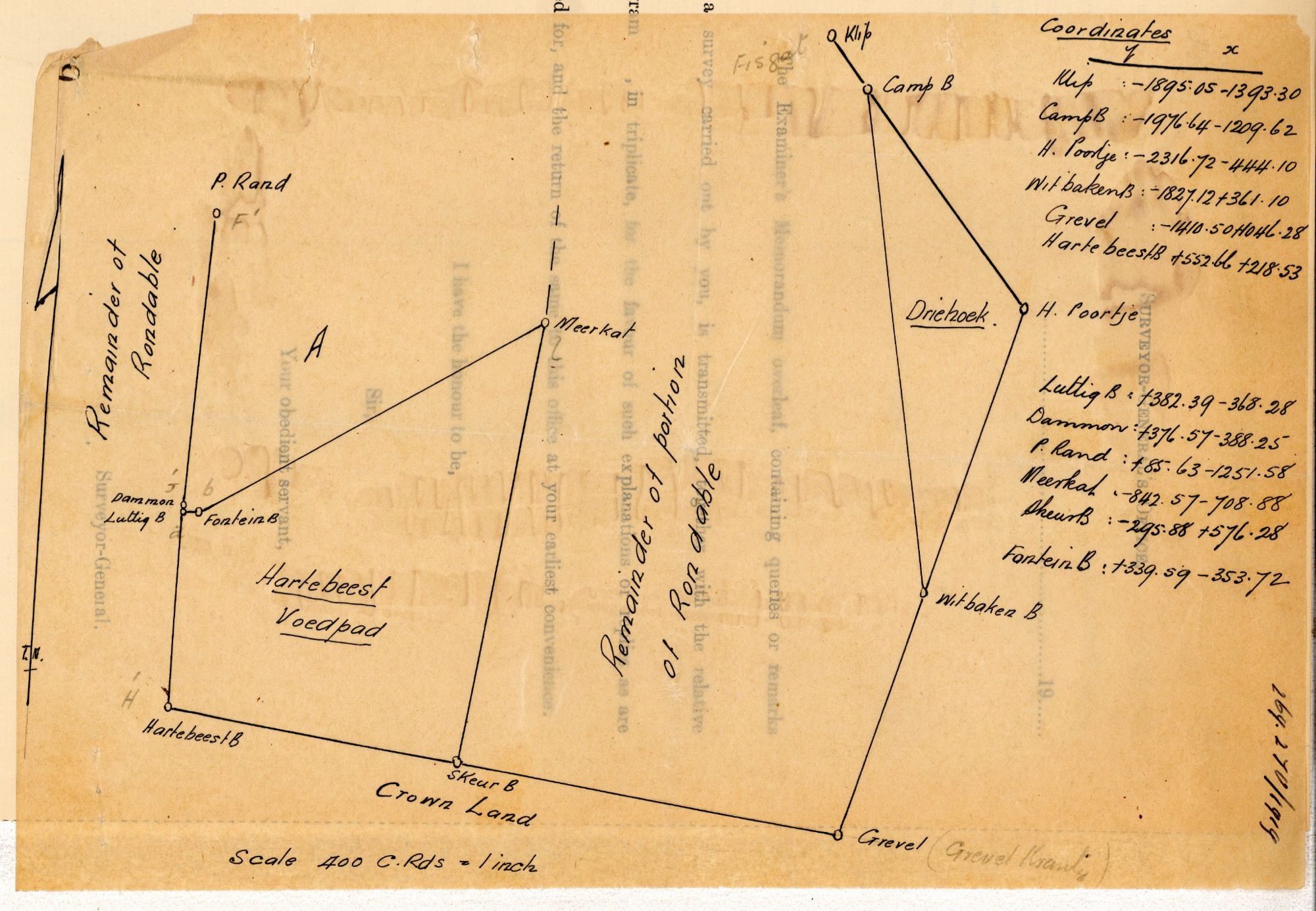
10747354 (1).PDF.The record
- Type
- Surveyor-General diagram
- Surveyed
- 1919
- Surveyor
- J.A. Loubser
- Archive filename
- 10747354 (1).PDF
Citation
- Title
- Rondabel field sketch with beacon coordinates
- Repository
- Surveyor-General
- Type
- SG diagram
The ground it is about
Rondabel 124
Research notes
Working sketch with beacon coordinates: Klip, Camp B, H. Poortje, Meerkat, Fontein B, Gravel Krantz, Hartebeest B, Skeur B, Witbaken B, P. Rand, Luttig B, Common B, Crown Land, Driehoek. [29 Jul 2026] On the sketch itself "Driehoek" is a LABELLED PIECE OF GROUND east of the "Remainder of portion of Rondable" (between Camp B, H. Poortje and Witbaken B), not a beacon and not a Rondabel portion - see PAR-000046 for the probable identification with Oude Muure Ptn 2/121.
The research behind this page, kept separate from it: dated working notes, open questions, and what is not yet settled.