Surveyor-General diagram, 270/1919, January 1919
Surveyor-General diagram, January 1919
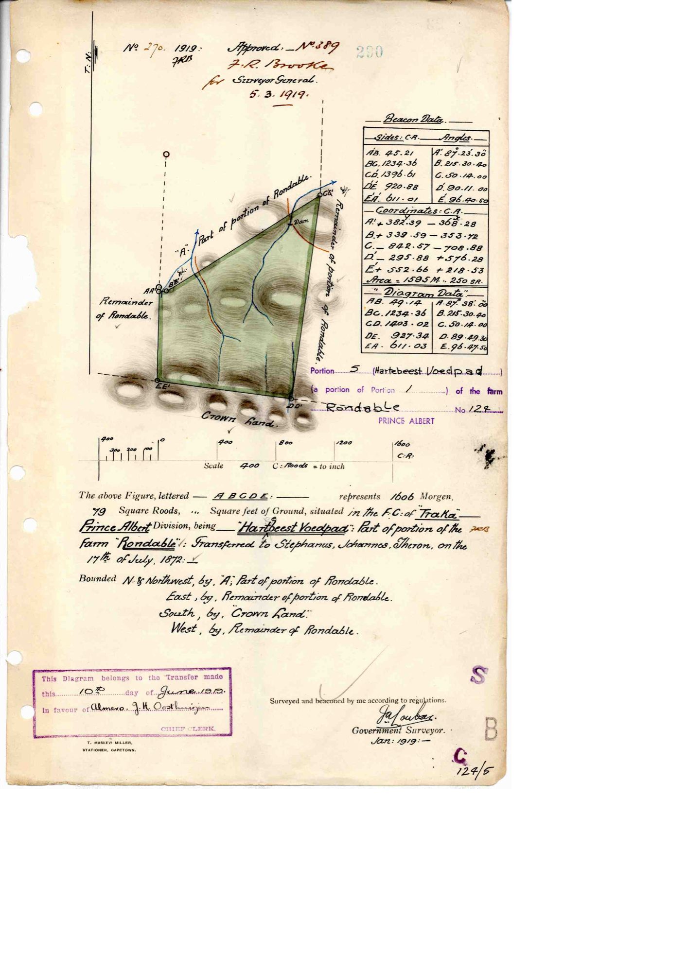
10747350 (1).PDF.The record
- Type
- Surveyor-General diagram
- Diagram number
- 270/1919
- Surveyed
- January 1919
- Titled
- 10 June 1919
- Surveyor
- J.A. Loubser
- Archive filename
- 10747350 (1).PDF
Citation
- Title
- Rondabel Portion 5 "Hartebeest Voedpad" diagram
- Repository
- Surveyor-General
- Reference
- SG Dgm 270/1919
- Type
- SG diagram
The ground it is about
Rondabel 124
Research notes
Portion 5 "HARTEBEEST VOEDPAD", 1606 morgen 79 sq roods. Part of the portion of Rondable transferred to Stephanus Johannes TheronL 17 Jul 1872. Bounded S by CROWN LAND. "This Diagram belongs to the Transfer made this 10th day of June 1919 in favour of ALMERO J.H. OOSTHUIZEN."
The research behind this page, kept separate from it: dated working notes, open questions, and what is not yet settled.