Surveyor-General diagram, B355/1833, August 1833
Surveyor-General diagram, August 1833
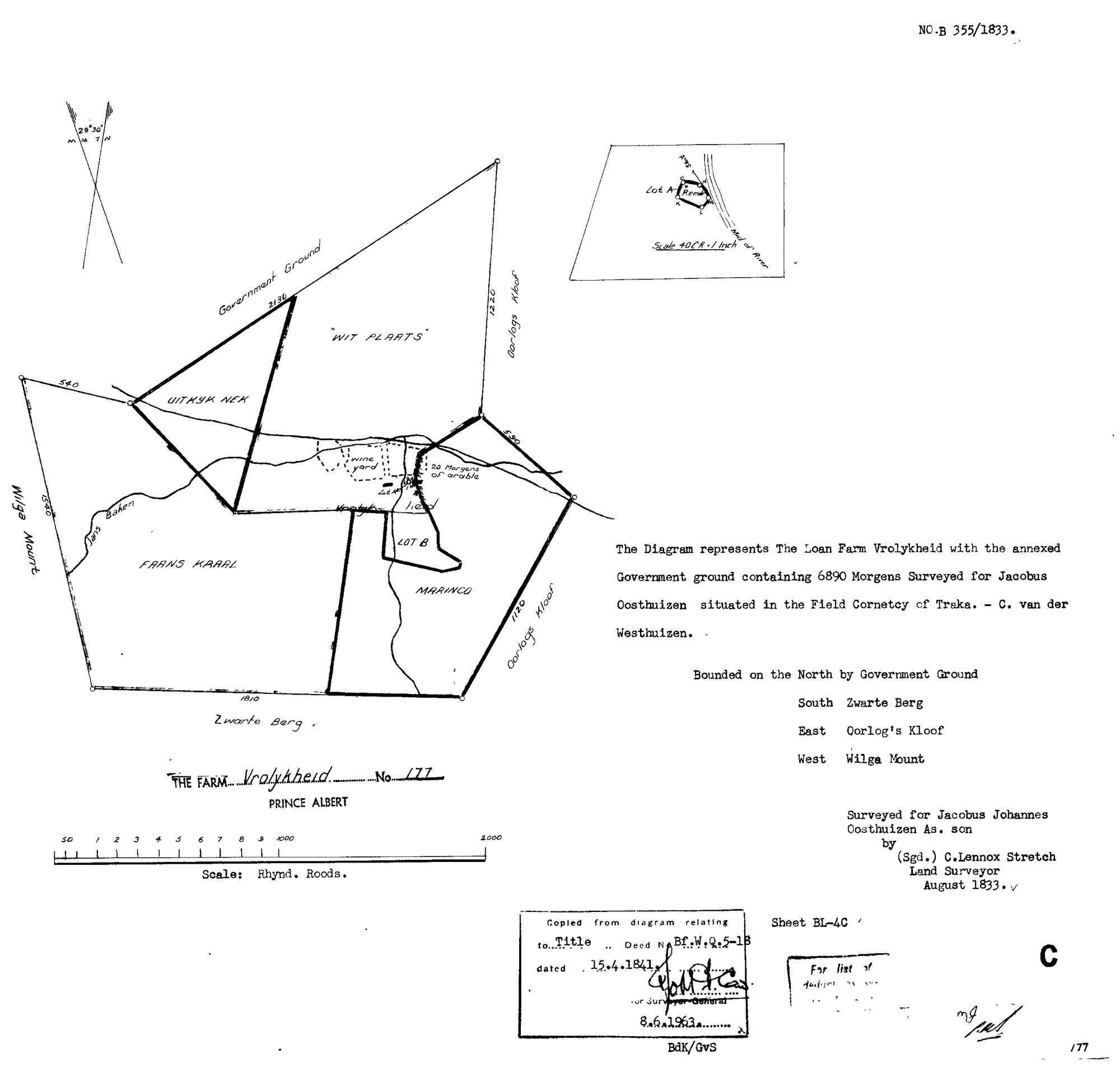
SCAN484.TIF.The record
- Type
- Surveyor-General diagram
- Diagram number
- B355/1833
- Surveyed
- August 1833
- Titled
- 15 April 1841
- Deed
- Bf.W.Q.5-1B
- Surveyor
- C. Lennox Stretch
- Archive filename
- SCAN484.TIF
Citation
- Title
- Vrolykheid No.177 original loan-farm diagram (1833)
- Repository
- Surveyor-General
- Reference
- SG Dgm B355/1833
- Type
- SG diagram
The ground it is about
Vrolikheid 177
Research notes
"The Loan Farm Vrolykheid with the annexed Government ground containing 6890 Morgens, Surveyed for Jacobus Johannes OosthuisenM As. son, Field Cornetcy of Traka." Bounded N Government Ground, S Zwarte Berg, E Oorlog's Kloof, W Wilga Mount. Internal names already shown: Wit Plaats, Uitkyk Hek, Frans Kraal, Marinco, Lot B. "As. son" locked in as "ALMERO'S SON": the survey applicant is probably Jacobus Johannes OosthuizenL (c.1785-1867, PER-000208), son of Ockert Almero (1755) - see PER-000043 for the full reasoning and the [TO VERIFY] that still guards it.
The research behind this page, kept separate from it: dated working notes, open questions, and what is not yet settled.