Landmeter-generaal-kaart, 523/1839, 1839
Landmeter-generaal-kaart, 1839
SCAN164 12 0.jpg.Die rekord
- Soort
- Landmeter-generaal-kaart
- Kaartnommer
- 523/1839
- Opgemeet
- 1839
- Getitel
- 15 April 1841
- Akte
- Bf.W.Q. 5-27
- Landmeter
- C. Lennox Stretch
- Argieflêernaam
- SCAN164 12 0.jpg
Sitasie
- Title
- SG Dgm 523/1839 - the farm Riet Fontein No. 12, Prince Albert
- Repository
- Landmeter-Generaal, Kaapstad
- Reference
- No. 523/1839; C.L. Stretch, Land Surveyor, 1839; title Bf.W.Q. 5-27 of 15 April 1841; copied 8 September 1966; CANCELLED 2 October 1969, vide Farm 12 (P.A.Q. 1-24)
- Type
- SG diagram
- Retrieved
- 2026-08-04
Die grond waaroor dit gaan
Navorsingsnotas
Cancelled 2 Oct 1969 vide Farm 12 (P.A.Q. 1-24).
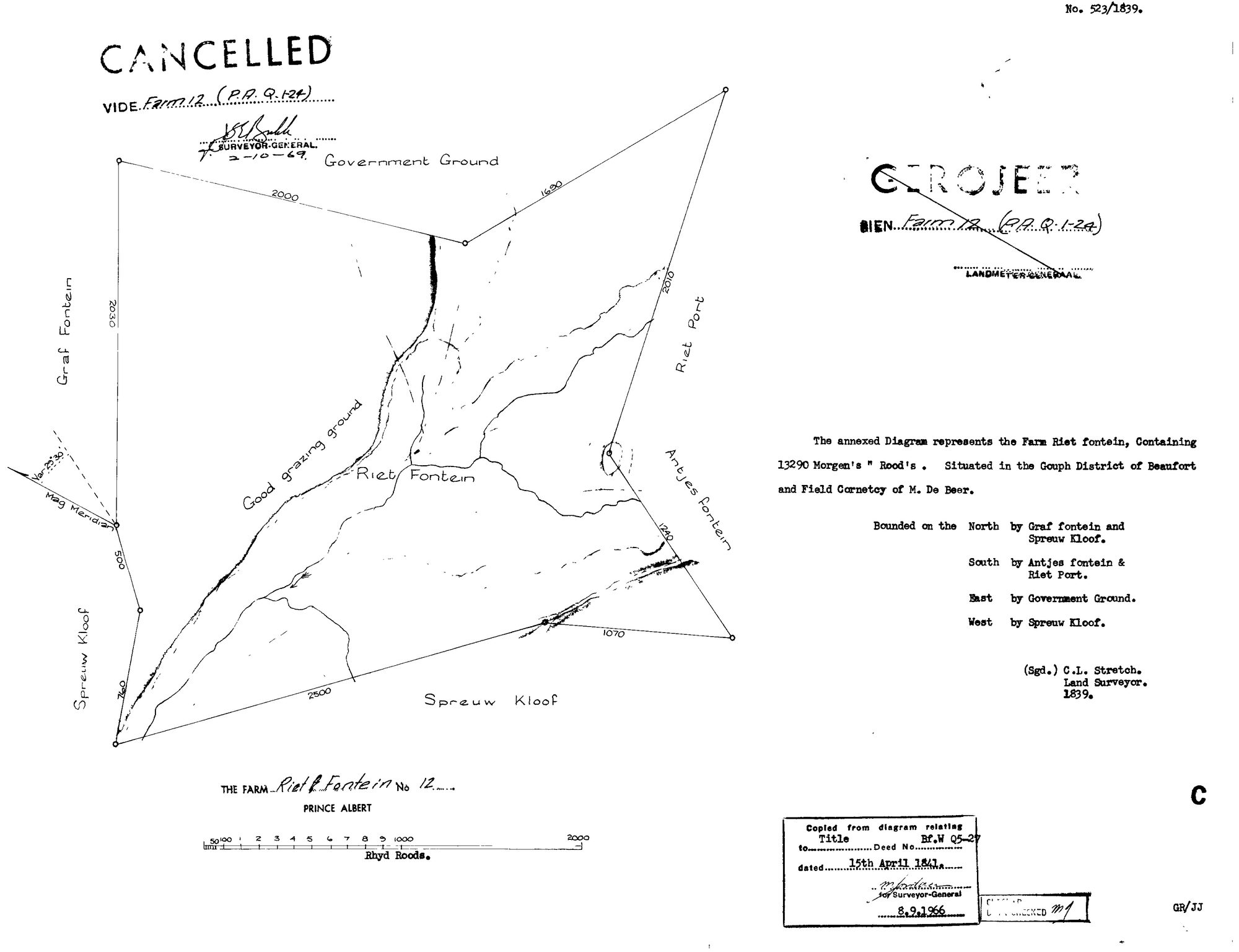
[8 Aug 2026, read] SG 523/1839, C. L. STRETCH, Land Surveyor, 1839. 'The annexed Diagram represents the FARM RIET FONTEIN, Containing 13290 Morgen's. Situated in the GOUPH DISTRICT OF BEAUFORT and FIELD CORNETCY OF M. DE BEER.' Bounded N Graf fontein and Spreeuw Kloof, S Antjes fontein & Riet Port, E Government Ground, W Spreeuw Kloof. Across the figure, along the watercourse, the surveyor has written 'GOOD GRAZING GROUND' - a judgement about the land in his own hand, which is rare on these sheets. Copied from the diagram to title Bf.W Q5-27 of 15 APRIL 1841 - the fourth farm in this project now shown to be titled that day - and stamped 8 Sept 1966. CANCELLED vide Farm 12 (P.A.Q.1-24) by the Surveyor-General on 2 Oct 1969, and separately GEROJEER (geroyeer) by the Landmeter-Generaal. Same ward as the Waterfall sheet, DOC-0220.
Die navorsing agter hierdie bladsy, apart gehou daarvan: gedateerde werksnotas, oop vrae, en wat nog nie uitgemaak is nie.
Die werksnotas op hierdie werf word in Engels gehou en word nie vertaal nie. Hulle verander met elke navorsingsessie, en 'n vertaling sou uit pas raak met die oorspronklike. Alles anders — die stories, die getranskribeerde dokumente en die koppelvlak — is in Afrikaans.