Kaart se keersy, 388/1816 (verso), 25 Januarie 1816
Kaart se keersy, 25 Januarie 1816
SCAN677.jpg.Die rekord
- Soort
- Kaart se keersy
- Kaartnommer
- 388/1816 (verso)
- Opgemeet
- 25 Januarie 1816
- Argieflêernaam
- SCAN677.jpg
Sitasie
- Title
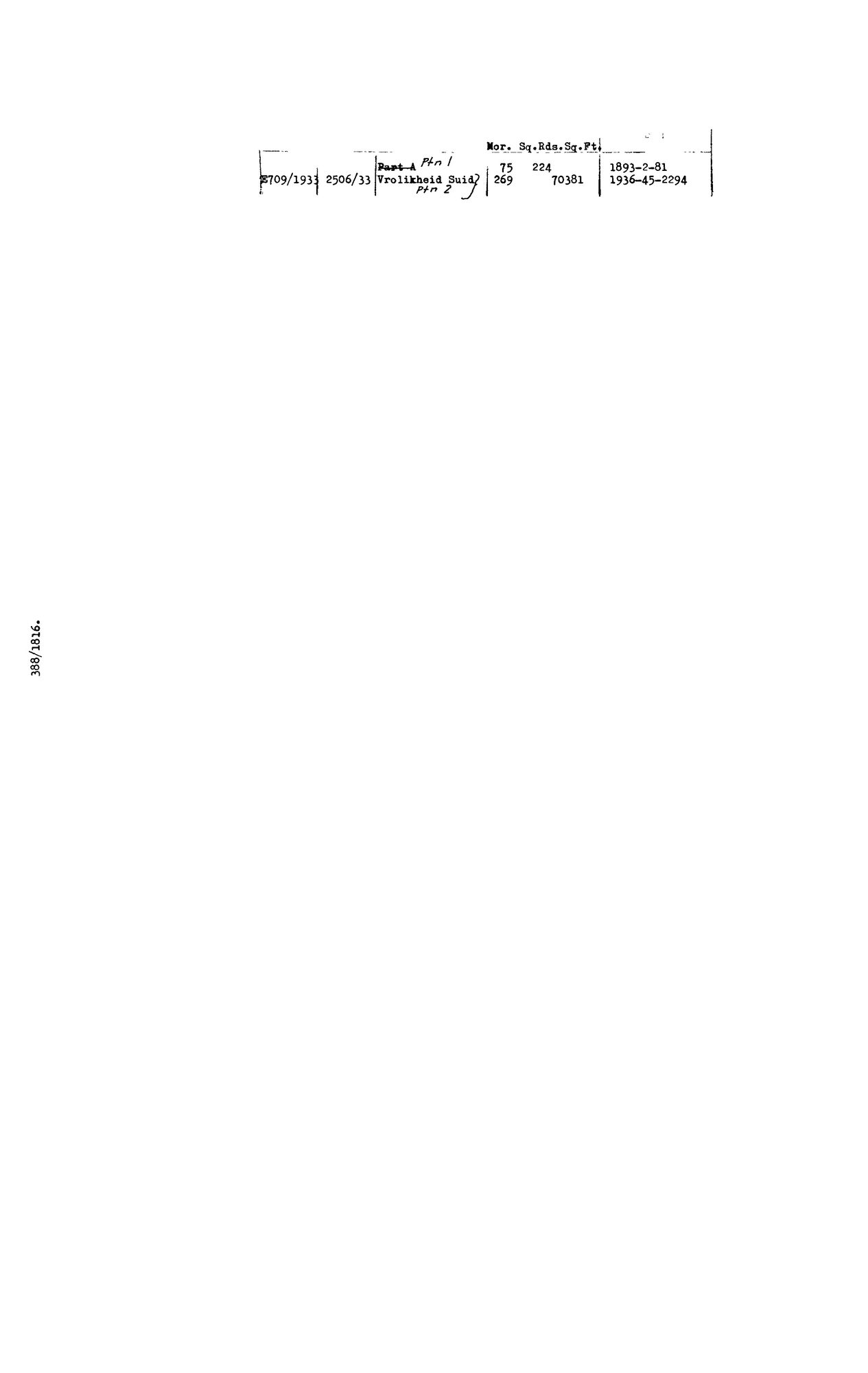
- Verso deduction table, SG diagram 388/1816, Vrolykheid No. 61, Tulbagh
- Repository
- Surveyor-General, Cape Town (SGCTN)
- Reference
- dgm 388/1816 verso
- Type
- SG_diagram
- Retrieved
- 2026-07-31
Die grond waaroor dit gaan
Navorsingsnotas
[31 Jul 2026 inbox] Verso deduction table of DOC-0074. Records the 1933 subdivision of Vrolykheid No. 61 into two portions - Ptn 1 (75 morgen 224 sq roods) and Ptn 2, named 'Vrolikheid Suid' (269 morgen). Note the spelling: the 1816 recto writes VrolYkheid, the 1933 annotation VrolIkheid - the same drift the Koup farm shows between its 1833 diagram and its modern cadastre entry. Same-name evidence, not the same farm.
[5 Aug 2026] doc_type corrected from SG_diagram to SG_diagram_verso. This row's sg_diagram_no already carried the '(verso)' suffix, so the scan gate read it correctly, but render.DOC_TYPE_LABEL maps the two types to different public labels - the site called this back of a sheet a 'Surveyor-General diagram' - and every per-type count double-counted a front. The 31 Jul verso batch predates the convention 8 records.
Die navorsing agter hierdie bladsy, apart gehou daarvan: gedateerde werksnotas, oop vrae, en wat nog nie uitgemaak is nie.
Die werksnotas op hierdie werf word in Engels gehou en word nie vertaal nie. Hulle verander met elke navorsingsessie, en 'n vertaling sou uit pas raak met die oorspronklike. Alles anders — die stories, die getranskribeerde dokumente en die koppelvlak — is in Afrikaans.