Landmeter-generaal-kaart, 1177/1940, Januarie 1940
Landmeter-generaal-kaart, Januarie 1940
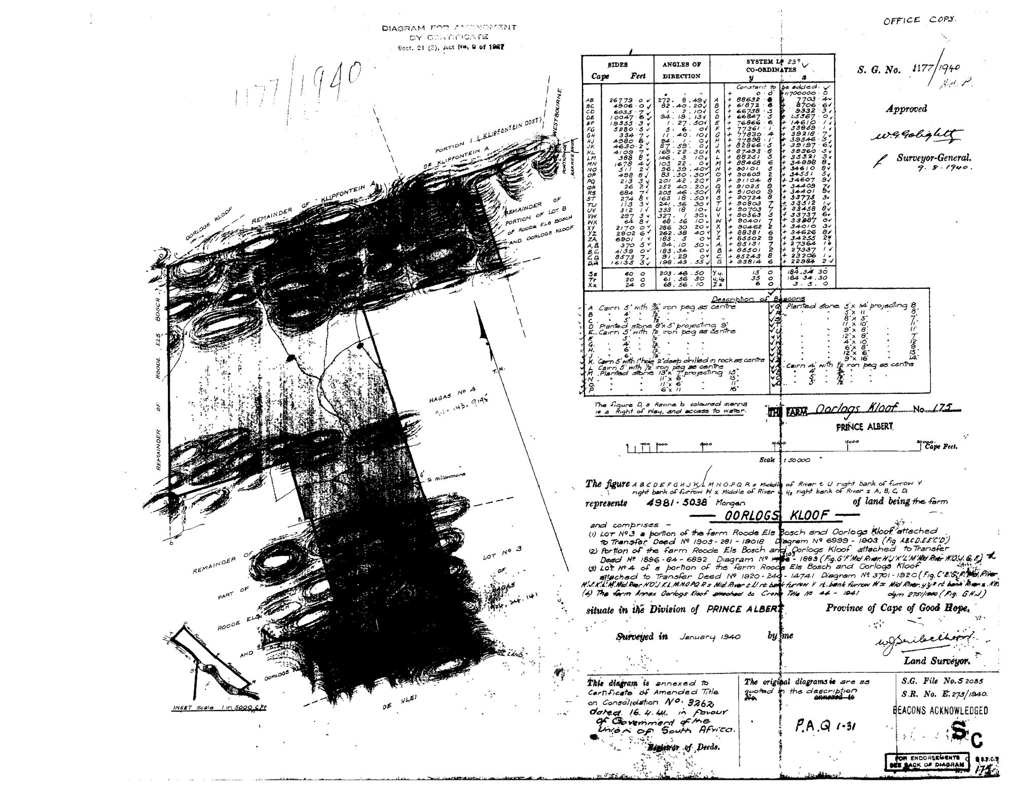
10JS4901.TIF.Die rekord
- Soort
- Landmeter-generaal-kaart
- Kaartnommer
- 1177/1940
- Opgemeet
- Januarie 1940
- Getitel
- 16 April 1941
- Akte
- 3262
- Landmeter
- W.J. Seibelhoff (signature, reading uncertain)
- Argieflêernaam
- 10JS4901.TIF
Sitasie
- Title
- Oorlogs Kloof No.175 consolidation diagram, 1940
- Repository
- Surveyor-General
- Reference
- SG Dgm 1177/1940
- Type
- SG diagram
Die grond waaroor dit gaan
Oorlogs Kloof Nr. 175 (1940 consolidation) 175
Navorsingsnotas
"Diagram for Amendment by Certificate, Sect. 21(3), Act No. 9 of 1927." "The figure ... represents 4981.5038 Morgen of land being the farm OORLOGS KLOOF" No. 175, Prince Albert, "and comprises - (1) Lot No.3 a portion of the farm Roode Els Bosch and Oorlogs Kloof attached to Transfer Deed No 1903-281-19018, Diagram No 6999-1903; (2) Portion of the farm Roode Els Bosch and Oorlogs Kloof attached to Transfer Deed No 1896-84-6892, Diagram No [1103]-1893; (3) Lot No.4 of a portion of the farm Roode Els Bosch and Oorlogs Kloof attached to Transfer Deed No 1920-240-14741, Diagram No 3701-1920; (4) The farm Annex Oorlogs Kloof attached to Crown Title No 44-1941, dgm 2751/1940." Surveyed January 1940; approved 9.8.1940 (W.G. Golightly for Surveyor-General). "This diagram is annexed to Certificate of Amended Title on Consolidation No. 3262 dated 16.4.41 IN FAVOUR OF THE GOVERNMENT OF THE UNION OF SOUTH AFRICA." P.A.Q.1-31 quoted as the original title. S.G. File S2035, S.R. E.275/1940. Neighbours drawn: Oorlogs Kloof, Remainder of Klipfontein A, Portion 1 (Klipfontein Oost), Westbourne, Remainder of Roode Els Bosch, Remainder of Portion of Lot B of Roode Els Bosch and Oorlogs Kloof, Hagas No 4, De Vlei.
[3 Aug 2026] publish_ok=yes. This is an OLD FARM DIAGRAM held back only because a TRANSFER ENDORSEMENT on its face crosses the 1936 scan cut-off - the survey itself is from the 1920s or 1930s. The names on it are the surveyor, the neighbouring farms and a transferee of the 1930s or 1940, all long dead and most of them already published as person records here. Reviewed individually, not opened as a category.
Die navorsing agter hierdie bladsy, apart gehou daarvan: gedateerde werksnotas, oop vrae, en wat nog nie uitgemaak is nie.
Die werksnotas op hierdie werf word in Engels gehou en word nie vertaal nie. Hulle verander met elke navorsingsessie, en 'n vertaling sou uit pas raak met die oorspronklike. Alles anders — die stories, die getranskribeerde dokumente en die koppelvlak — is in Afrikaans.